In early December 2025 Fernando, Jim & Danny went to Panamint Valley.
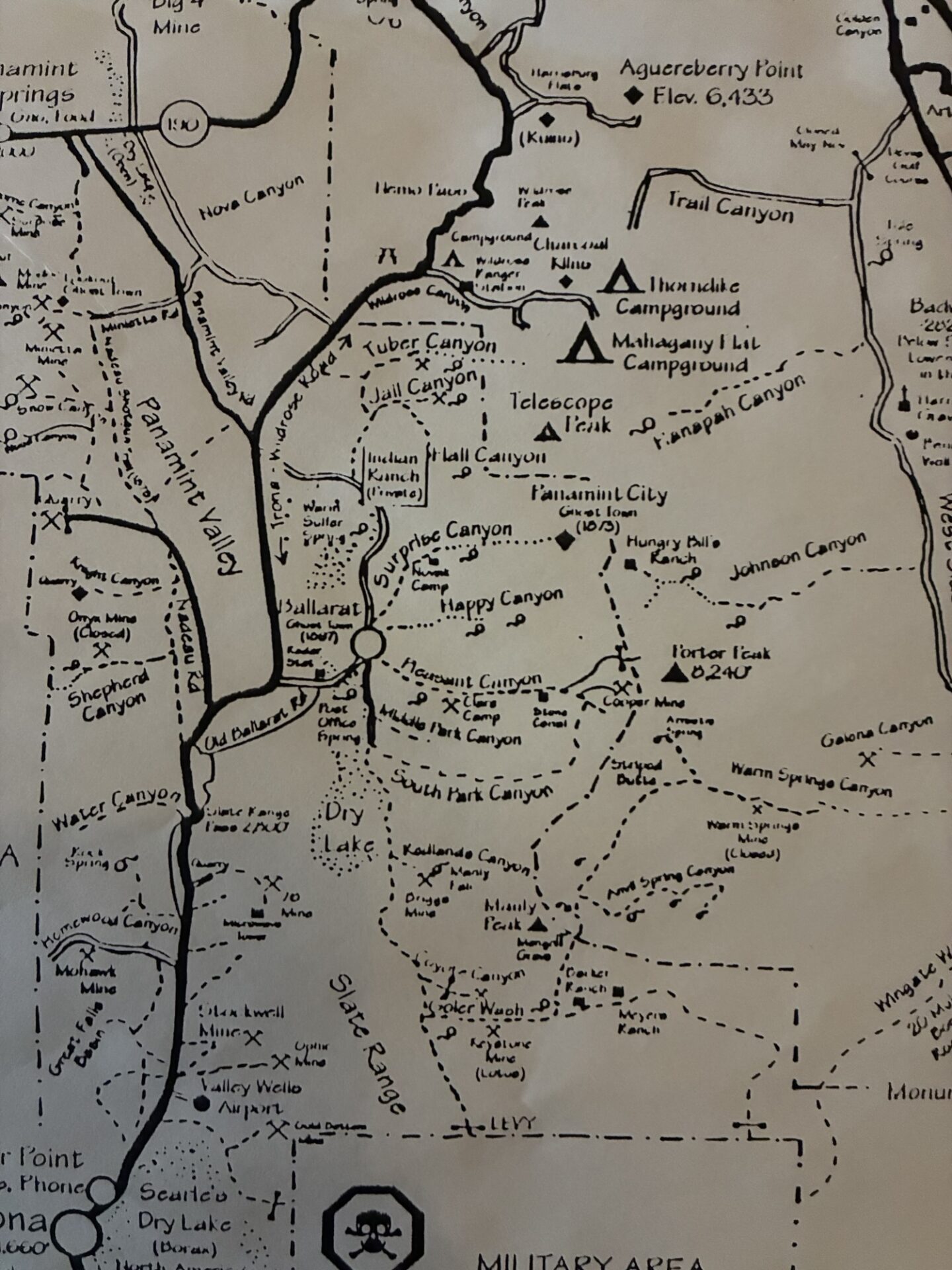
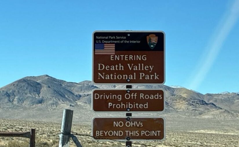
Much of western Death Valley was closed due to recent storm damage, but the Pleasant Canyon-South Park Canyon loop was open. Since the trail had been snowed-in the past few February club trips this was a great opportunity.
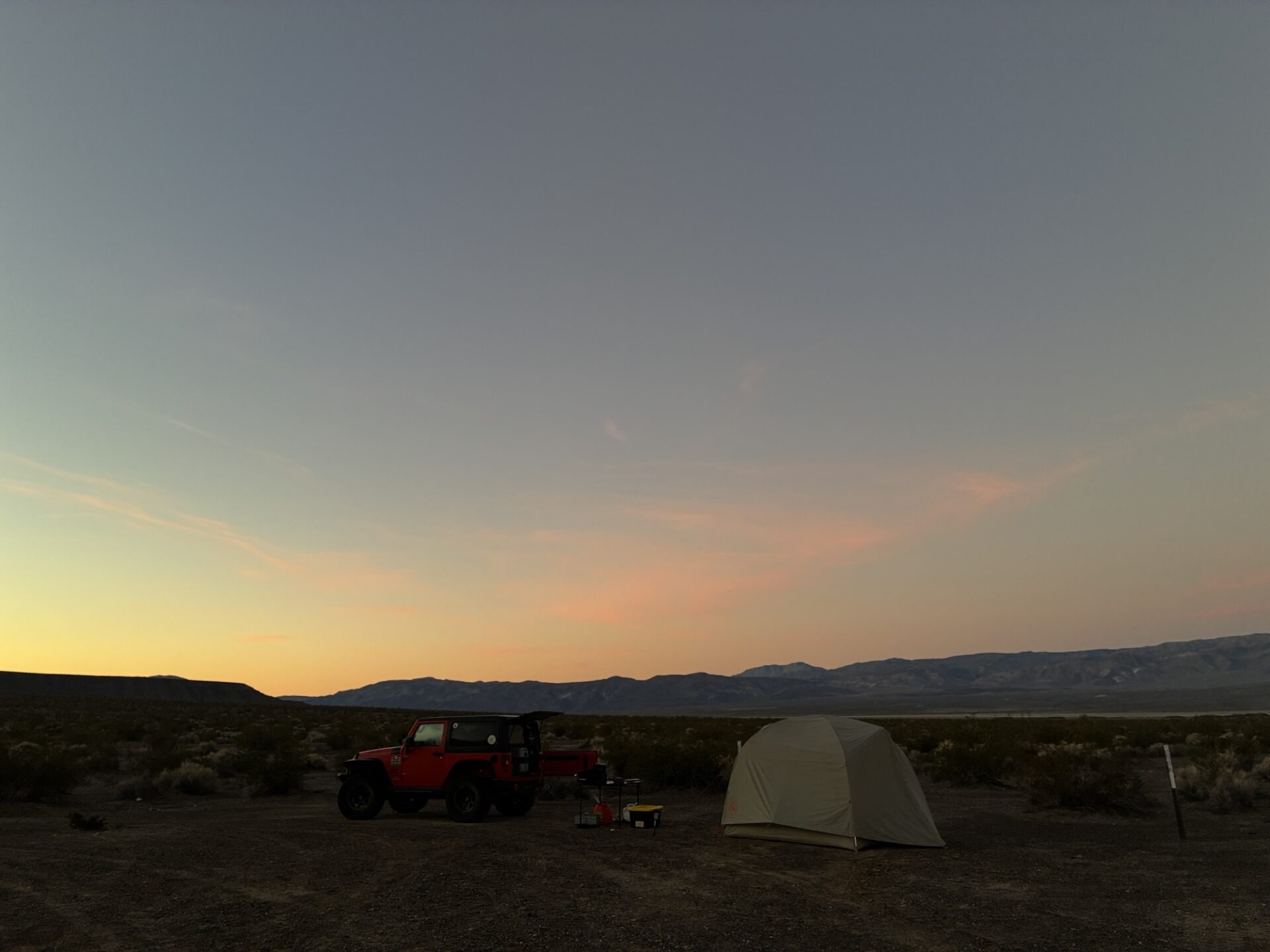
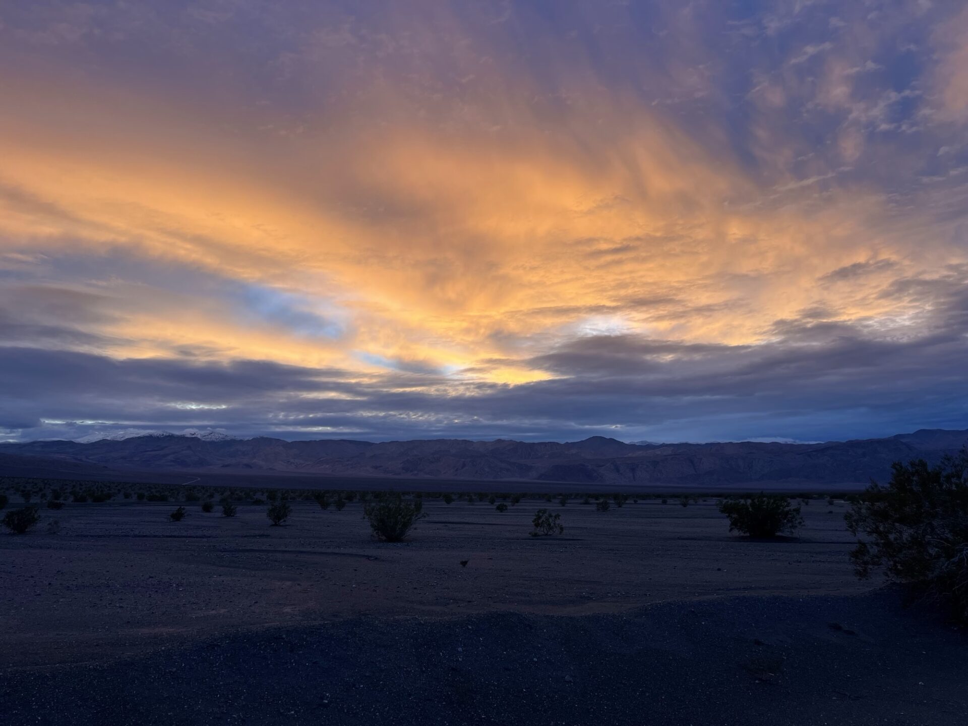
Danny, who was towing Annabelle with the Sprinter, left SB super early, and Jim and Fernando caught up just before Trona, where we refueled and got our traditional fried chicken from Chesters for lunch. Passing Ballarate we set up camp in our usual spot near the Surprise Canyon wilderness. The weather was perfect, low 70s on the valley floor, clear blue skies and absolutely no wind!
We set up camp with some daylight to spare and decided to check the condition of Surprise Canyon and Chris Wicht Camp, the trailhead to Panamint City, which we had not seen for a couple years. We discovered the road was blown out and impassable (at least for our vehicles) prior to Chris Wicht Camp.
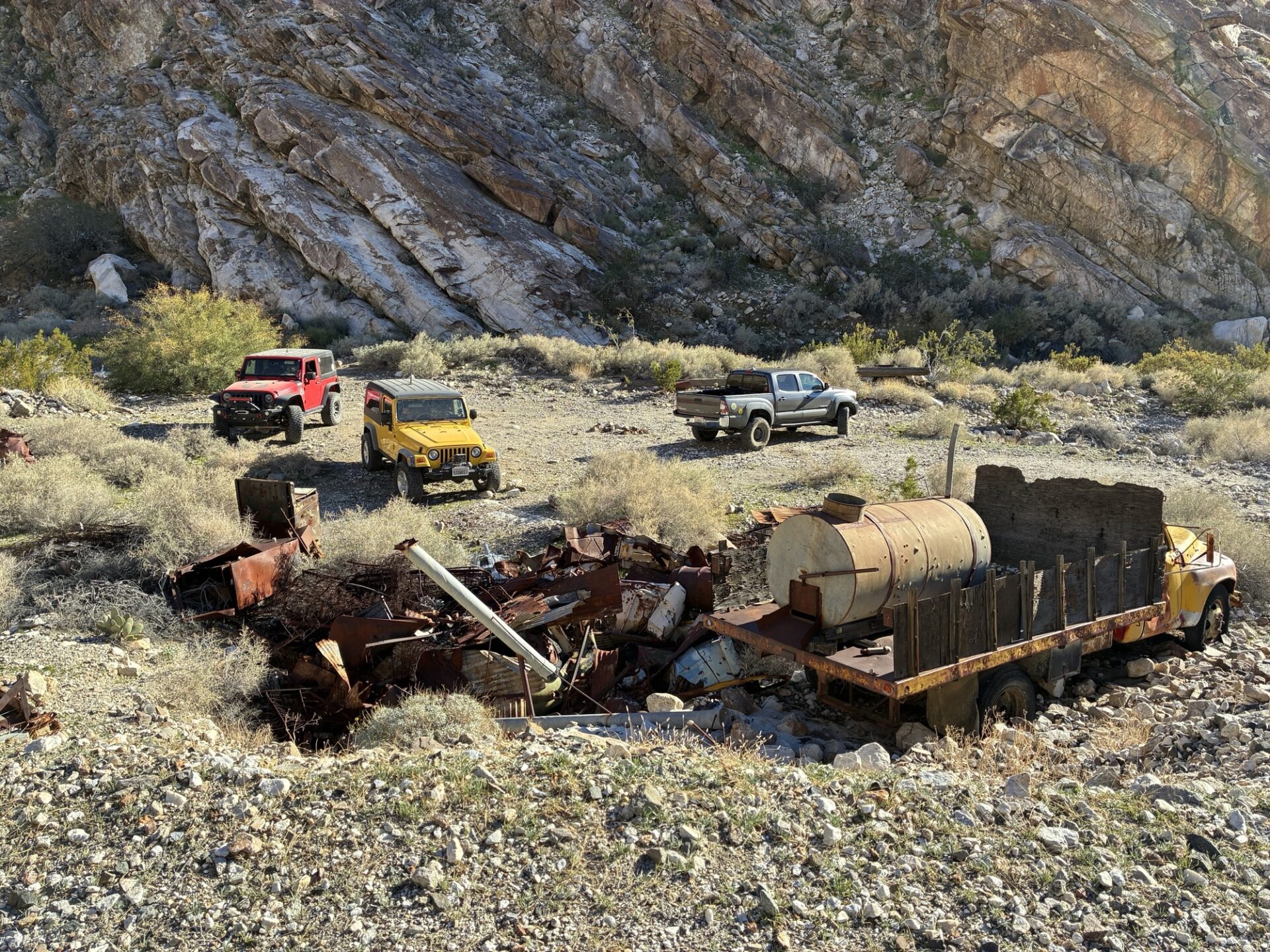
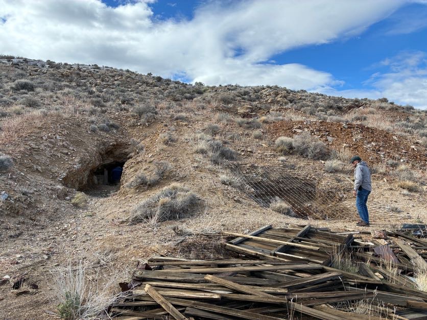
Next we checked out the condition of Jail Canyon,
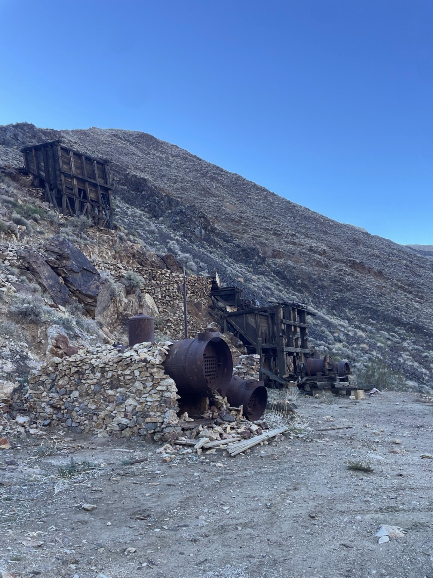
stopping at the Corona mine and checking out the infrastructure artifacts.
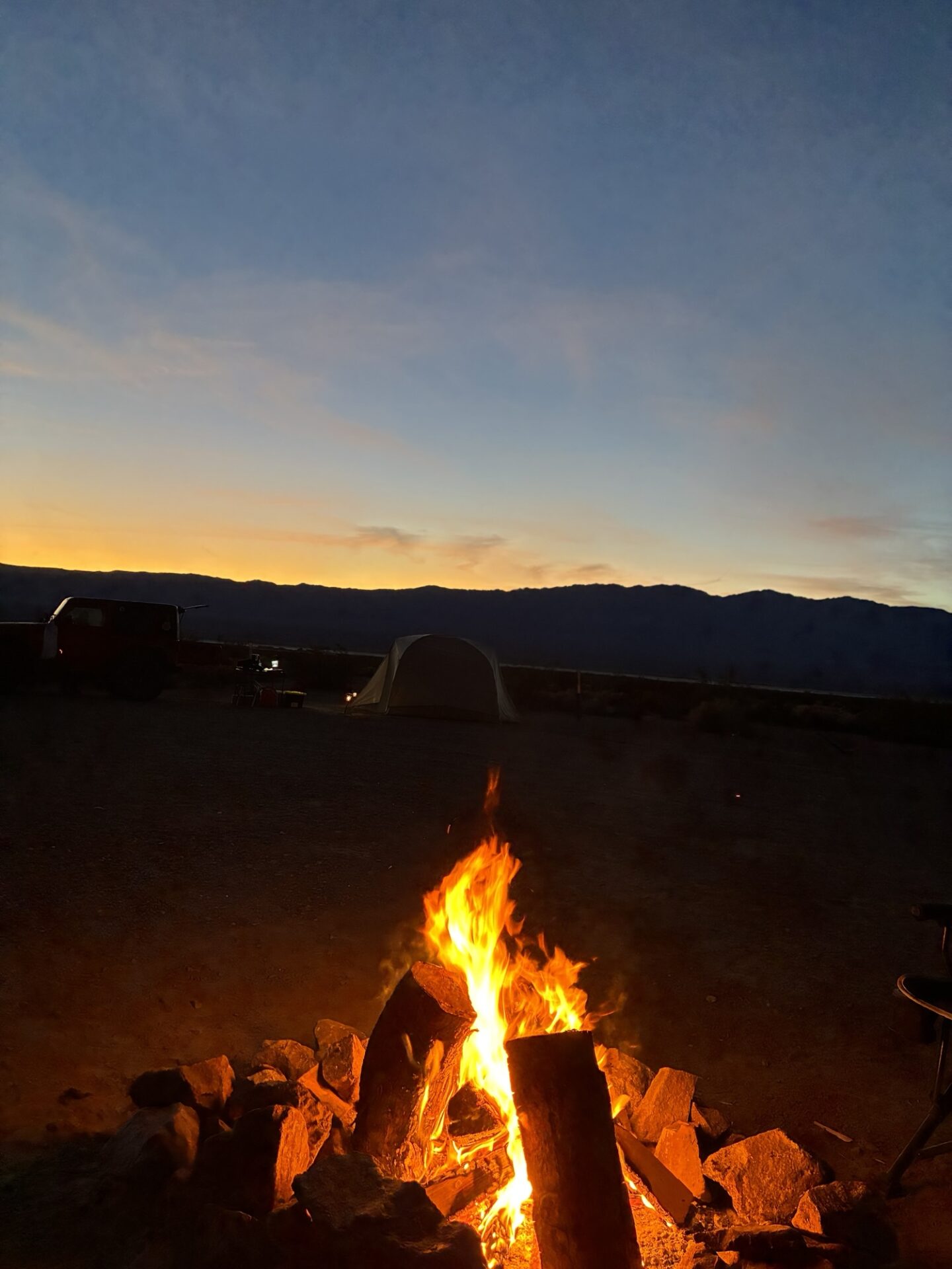
We headed back to camp and relaxed by a fire on a beautiful and starry (until the full moon came up) night.
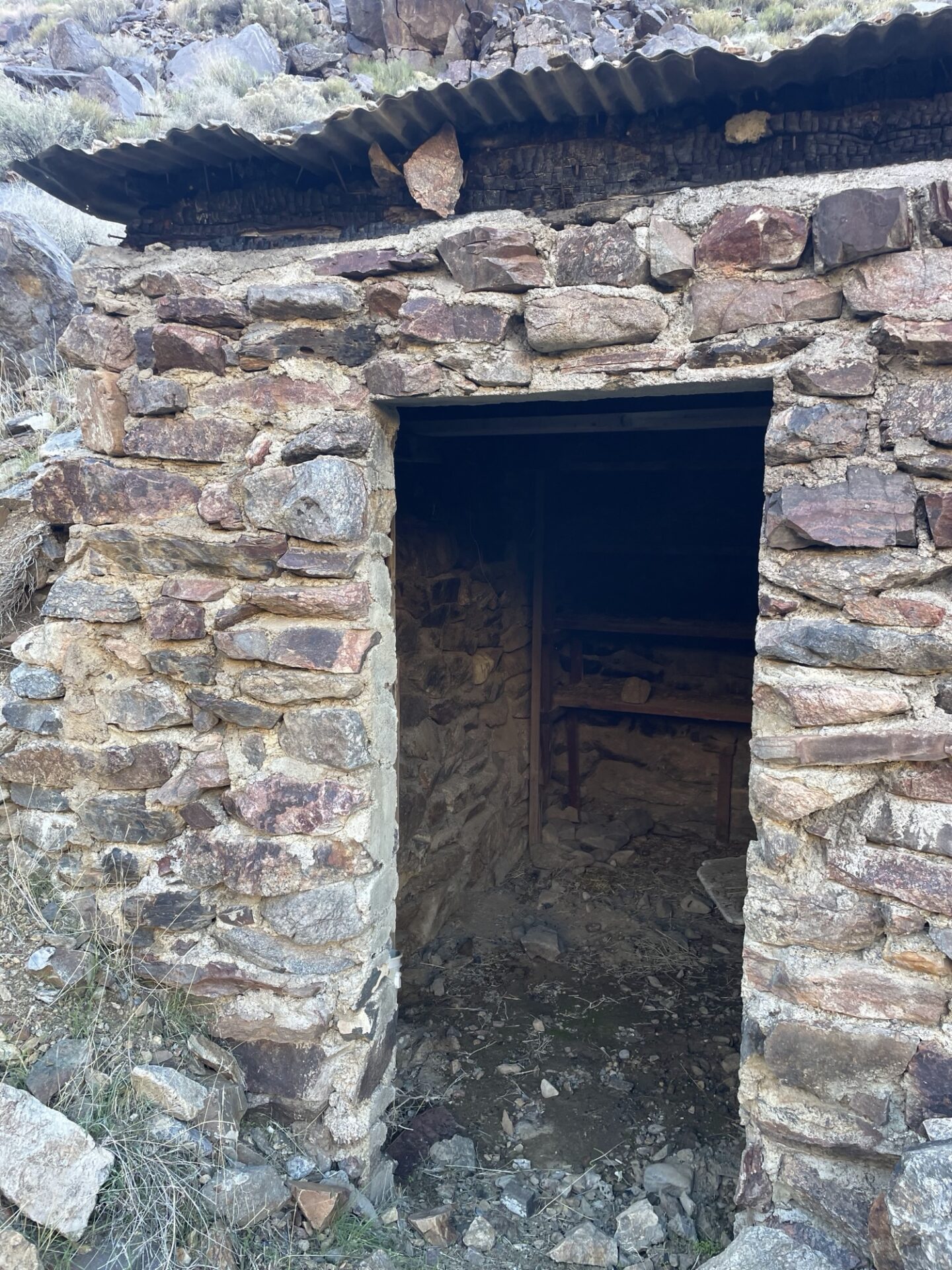
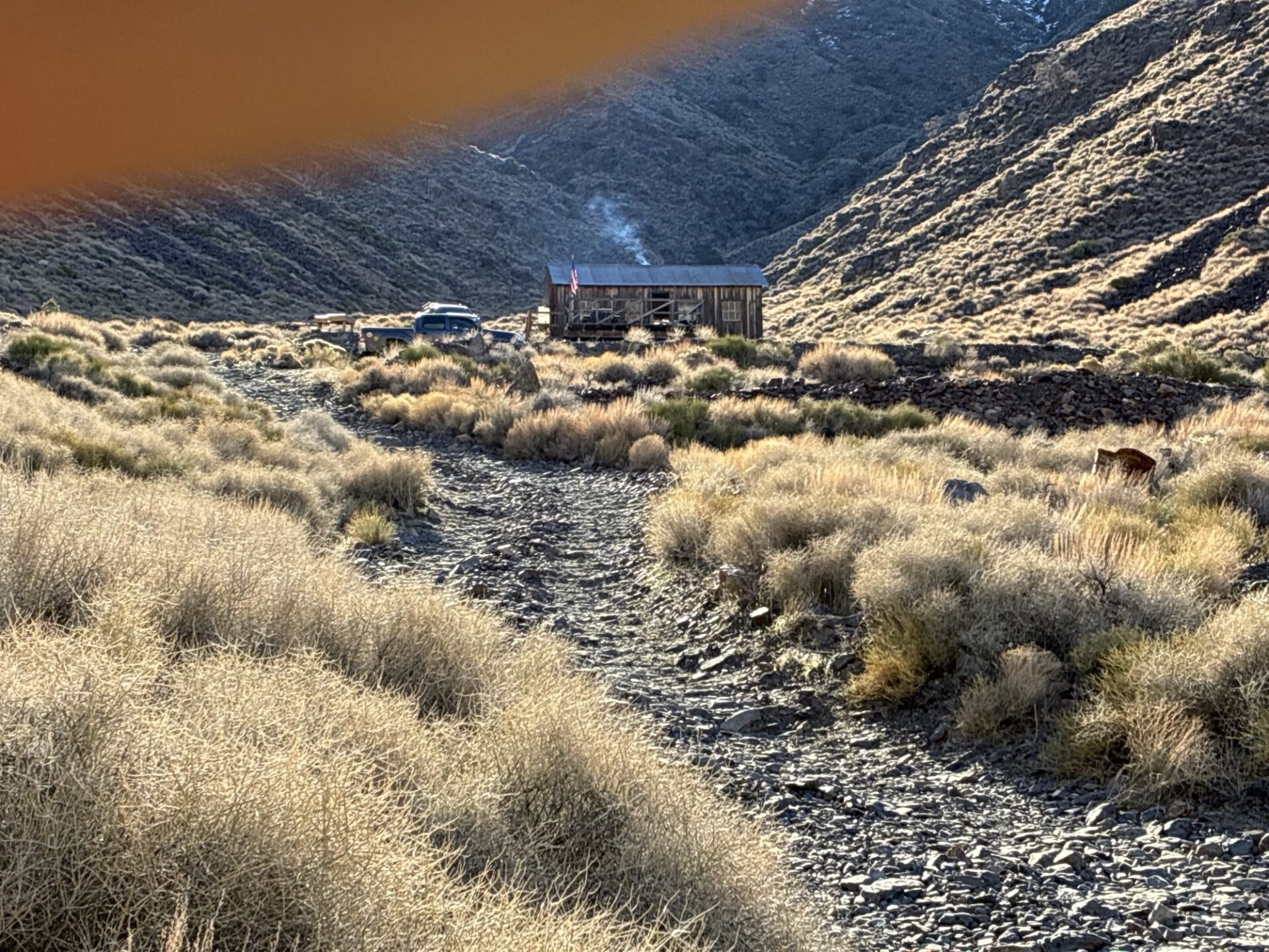
We woke early the next day and headed up beautiful Pleasant Canyon, stopping to check out various mining operations artifacts.
World Beater cabin was occupied, the current tenants enjoying a fire in the crisp Fall morning. They were the only people we saw all day.
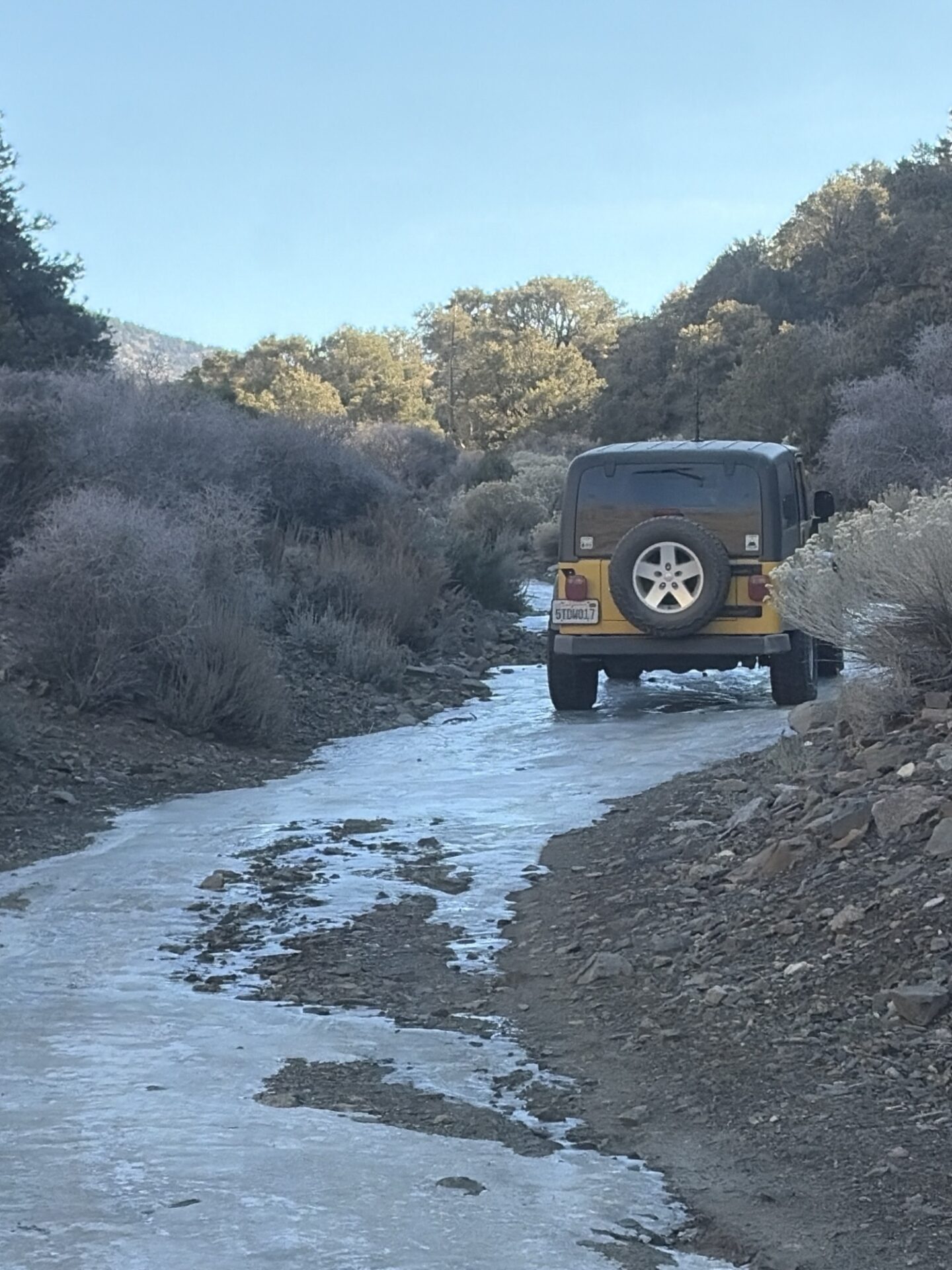
On the way up we checked out a couple lightly used side roads to old mines, seeing how far we could make it. Some were still snowy, and we were the first tracks since the recent storm.
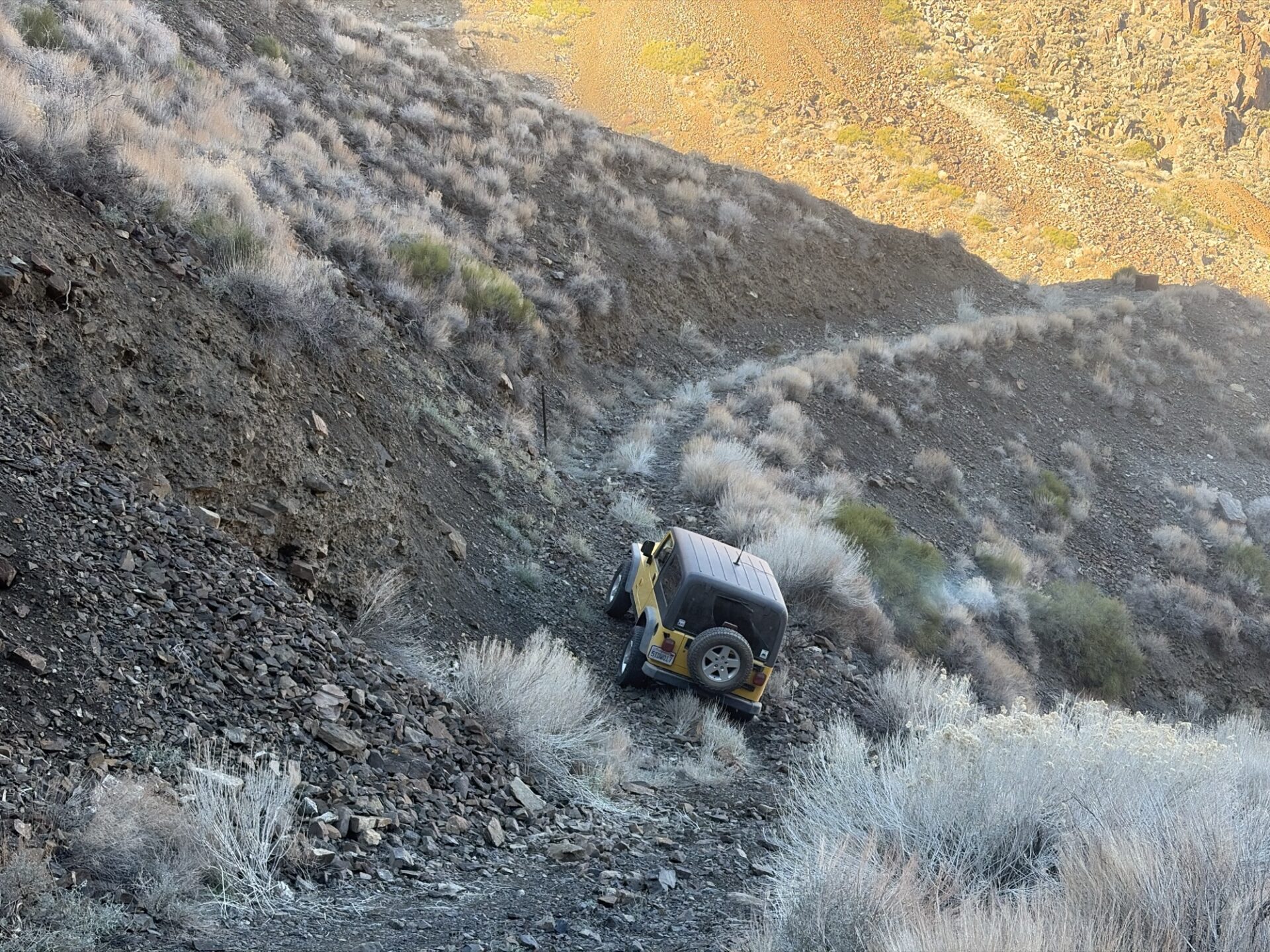
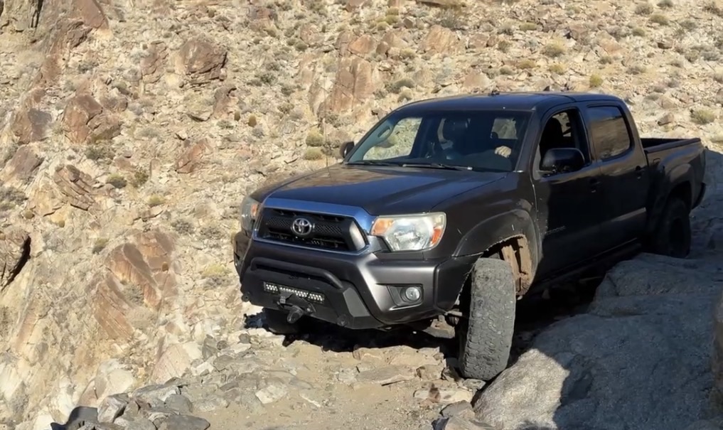
We tried to make it to World Beater Mine, but the road was blown out requiring a careful reverse down a steep rocky shelf road. The road to Radcliff, an active mining operation, was closed.
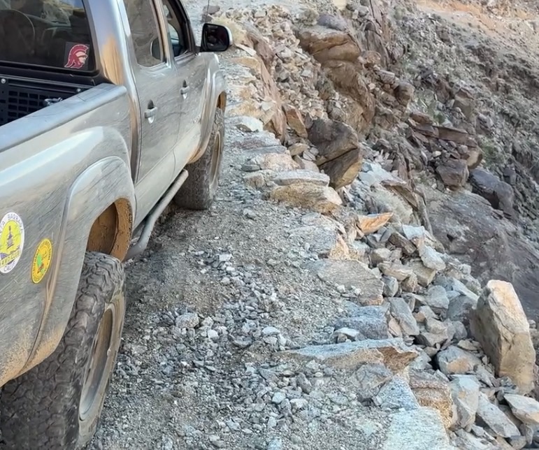
The road to Cooper Mine (or Copper Mine, depending upon which book you are reading) ended with a snowed-in dead end, requiring careful retreat in reverse to get to a turnaround spot.
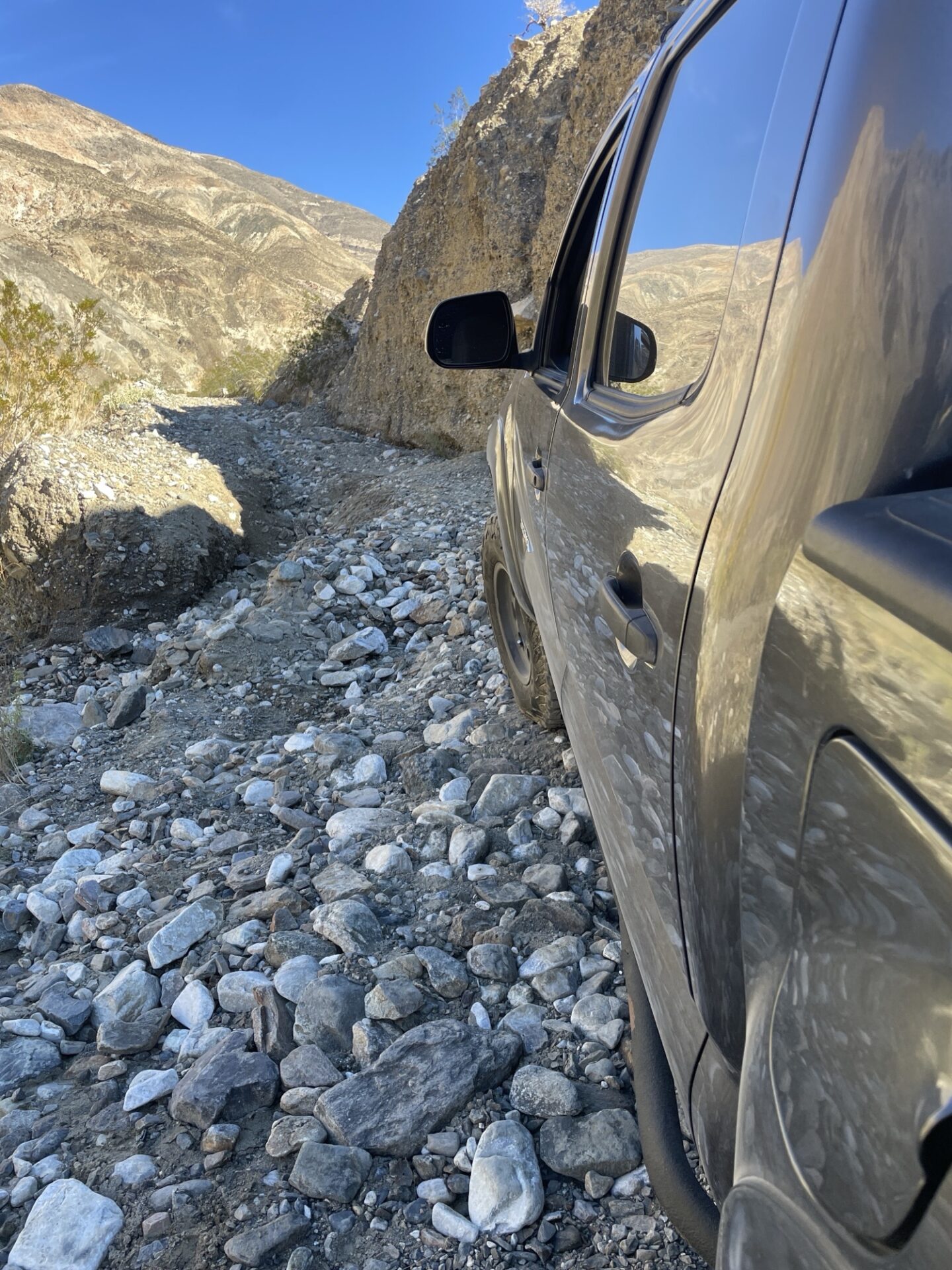
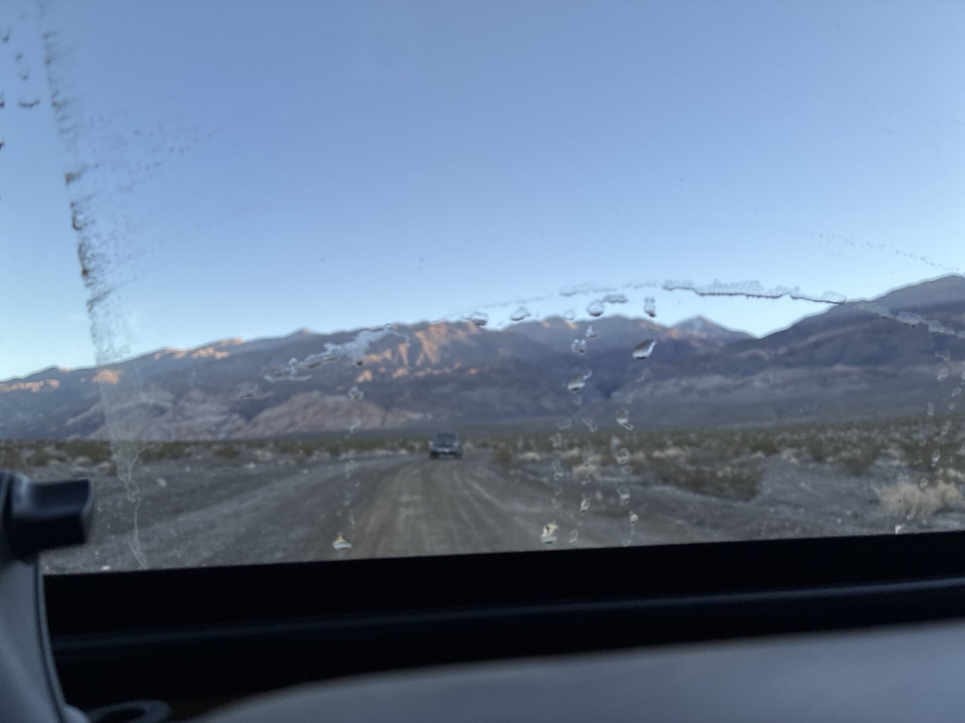
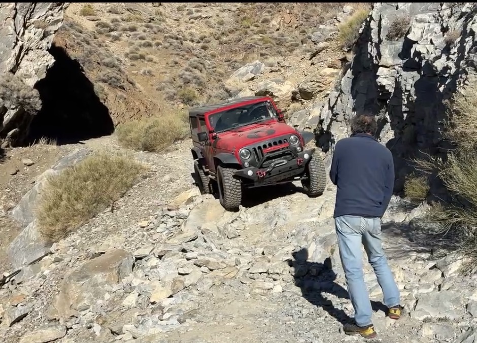
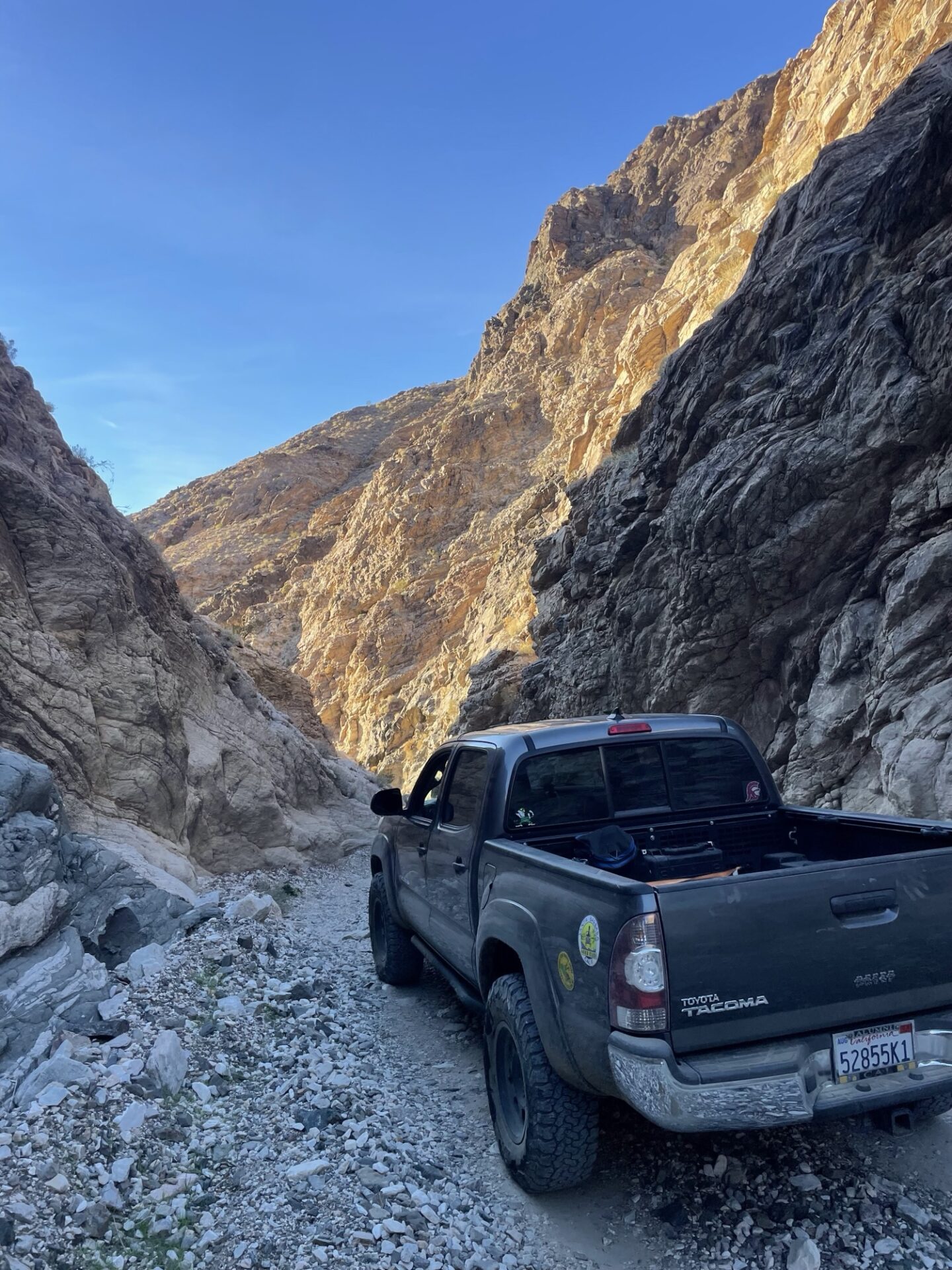
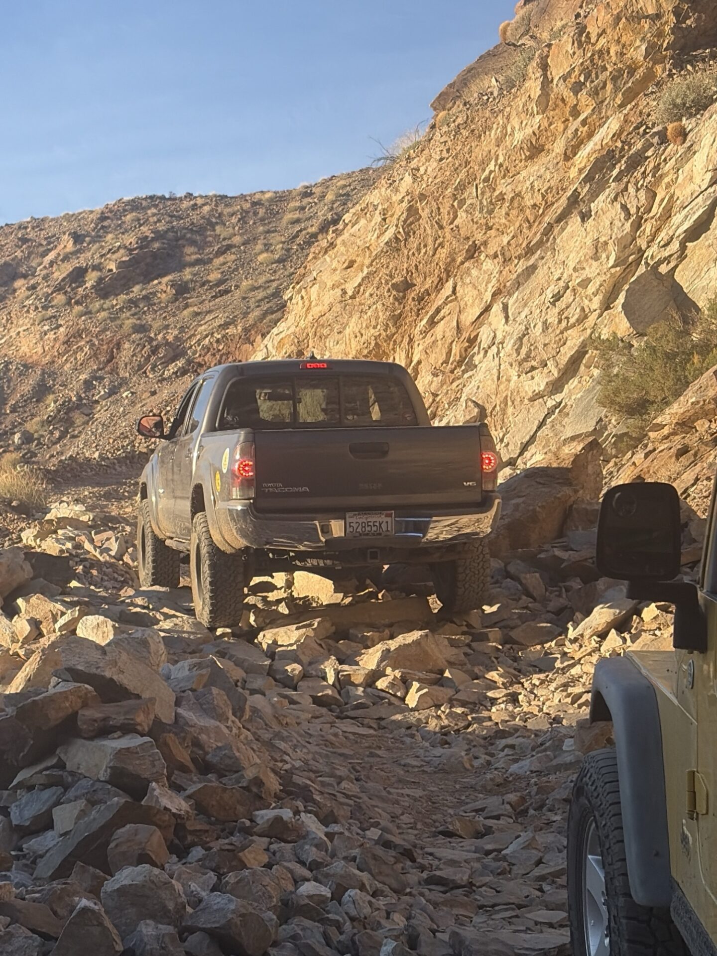
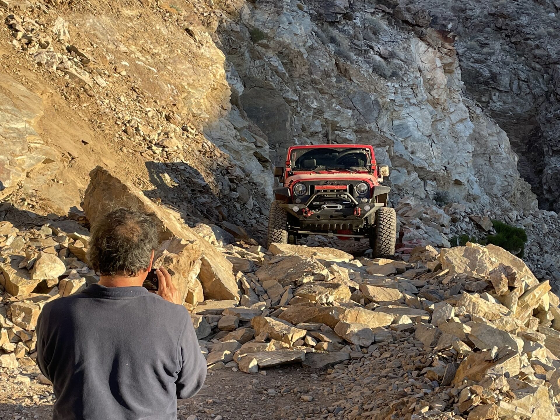
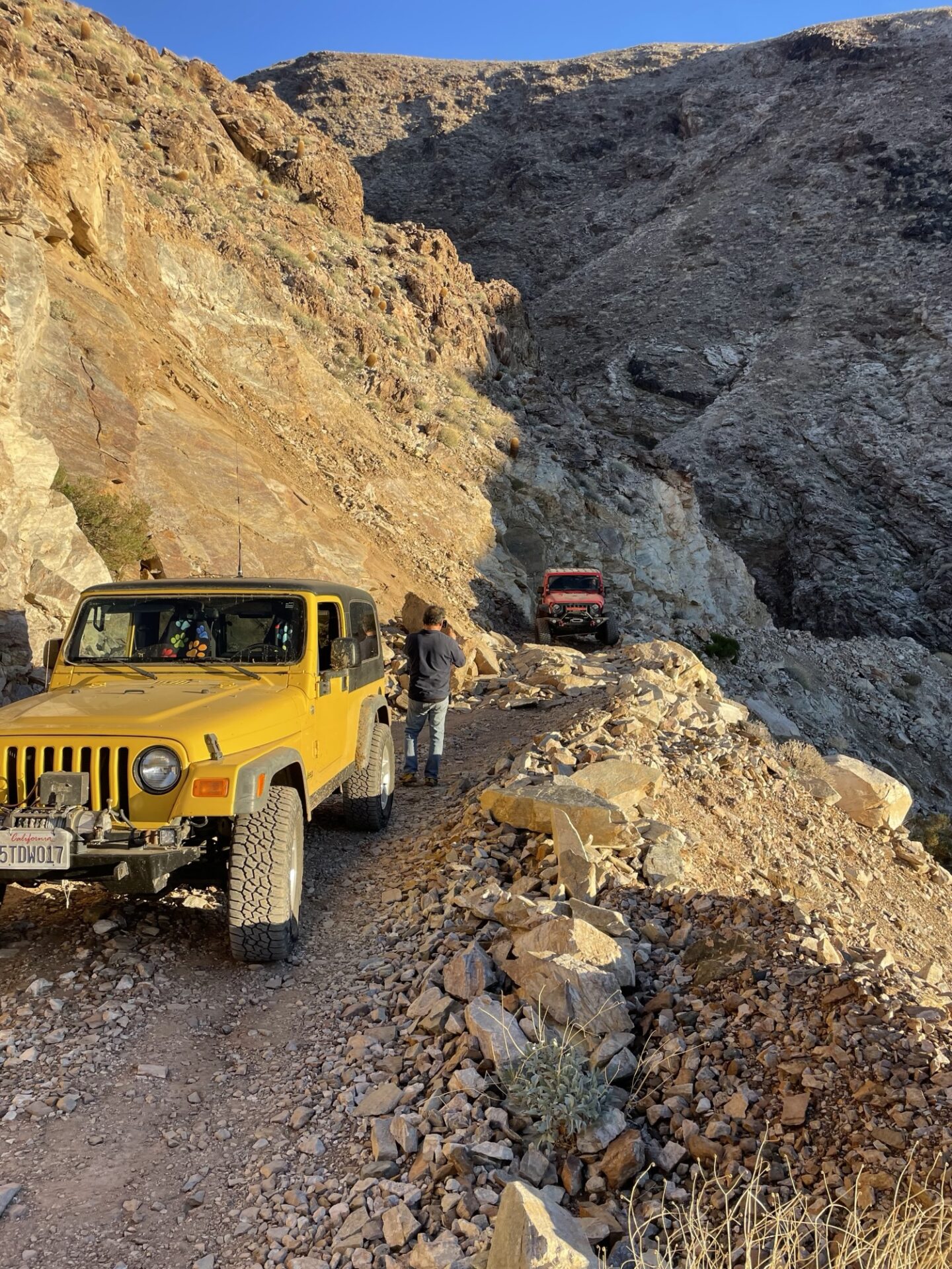
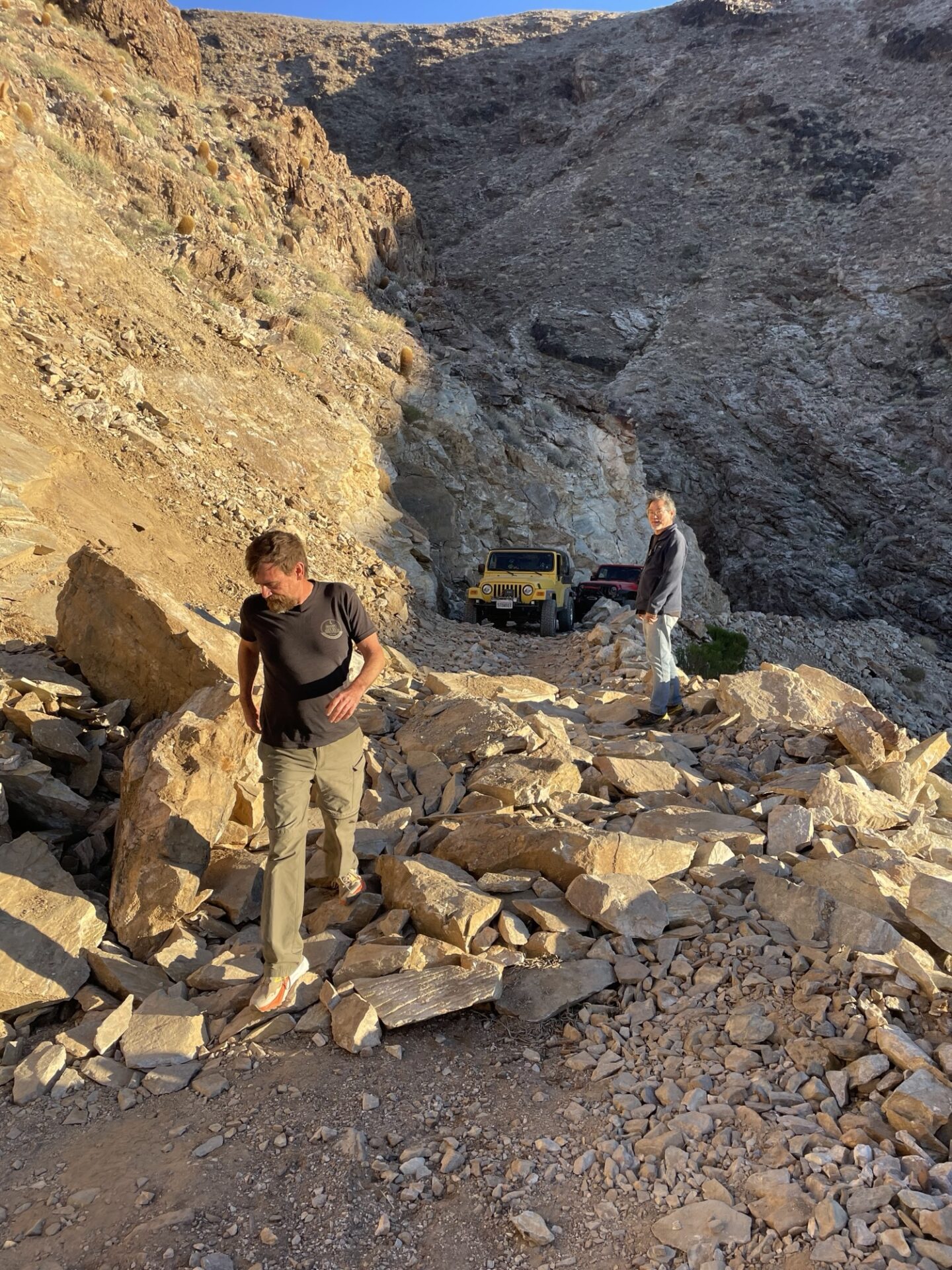
The group stopped for lunch near Rita’s Cabin and then continued on through Middle Park Canyon, looking down towards Death Valley and Striped Butte, which we saw in February from Geologists’ Cabin. We took the lower and more direct south-facing routes to stay out of the snow and get to South Park Canyon, wanting to be sure we had enough daylight to get past Chicken Rock and a recent landslide over the trail before dark.
Chicken Rock is scary, as advertised. Members check out the photo album for some videos, including Danny’s from inside the vehicle.
Briggs Camp was unoccupied, and it is in amazing condition, the Friends of Briggs do a great job.
We made it to the landslide, which had been cleared enough to get through with some spotting. Which was a good thing as the sun was getting low and it had taken us all day to get there.
We returned to camp and had another great night sitting by the fire with no wind.
The next day we spent hiking, exploring nearby canyons. We refueled in Panamint Springs, and treated ourselves to some delicious burgers at Panamint Springs Resort.
We drove back to camp in the dark, and enjoyed our third and final gorgeous windless night by the fire.
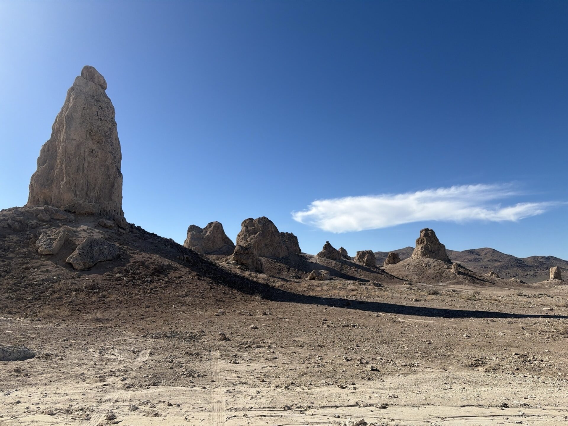
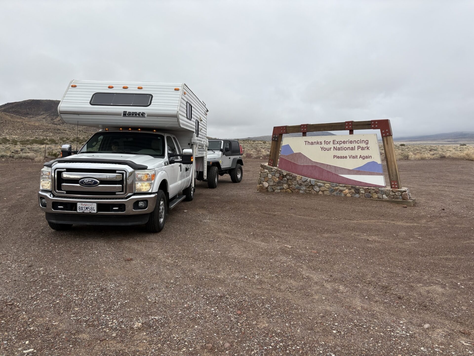
The next day we had a leisurely morning packing up and headed home, stopping at the Pinnacles for lunch.
Participants: Danny and Myla Kato, Brad Burk, Bobbie Okamoto-Subject, George and Pam Tinker, Steve Smith
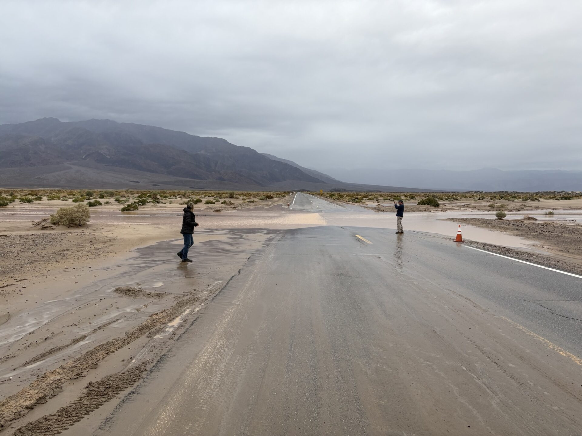
All except Steve arrived at the Stovepipe Wells Campground around 2:30pm. All were in front of the rainstorm that hit Santa Barbara. Since it had been raining for 8-10 days already, the ground was fairly wet, and muddy in parts.
Everyone got set up when the showers started. Not too much, but enough to be a nuisance. Several of us went across the street to have drinks and dinner at the Stovepipe Wells Hotel restaurant and bar.
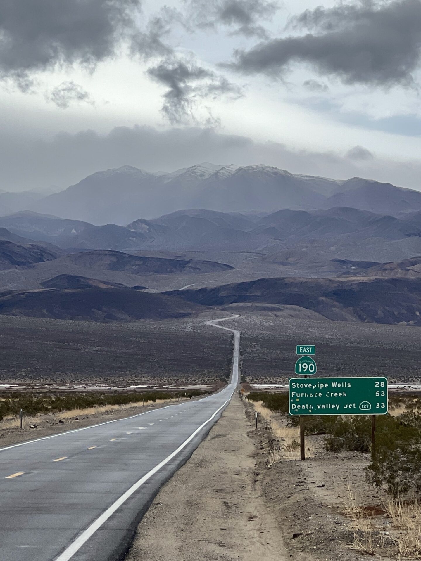
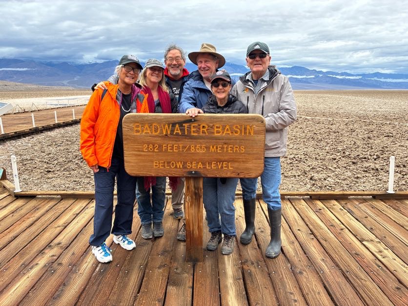
The next morning (Friday) it was still drizzling, so it was a slow morning. We decided to stay on paved roads, and do some touristy things, so we went to the Furnace Creek Ranger Station, then drove to Badwater to see the lake that was there after the rains.
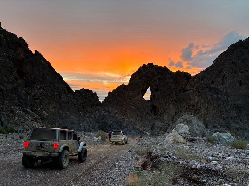
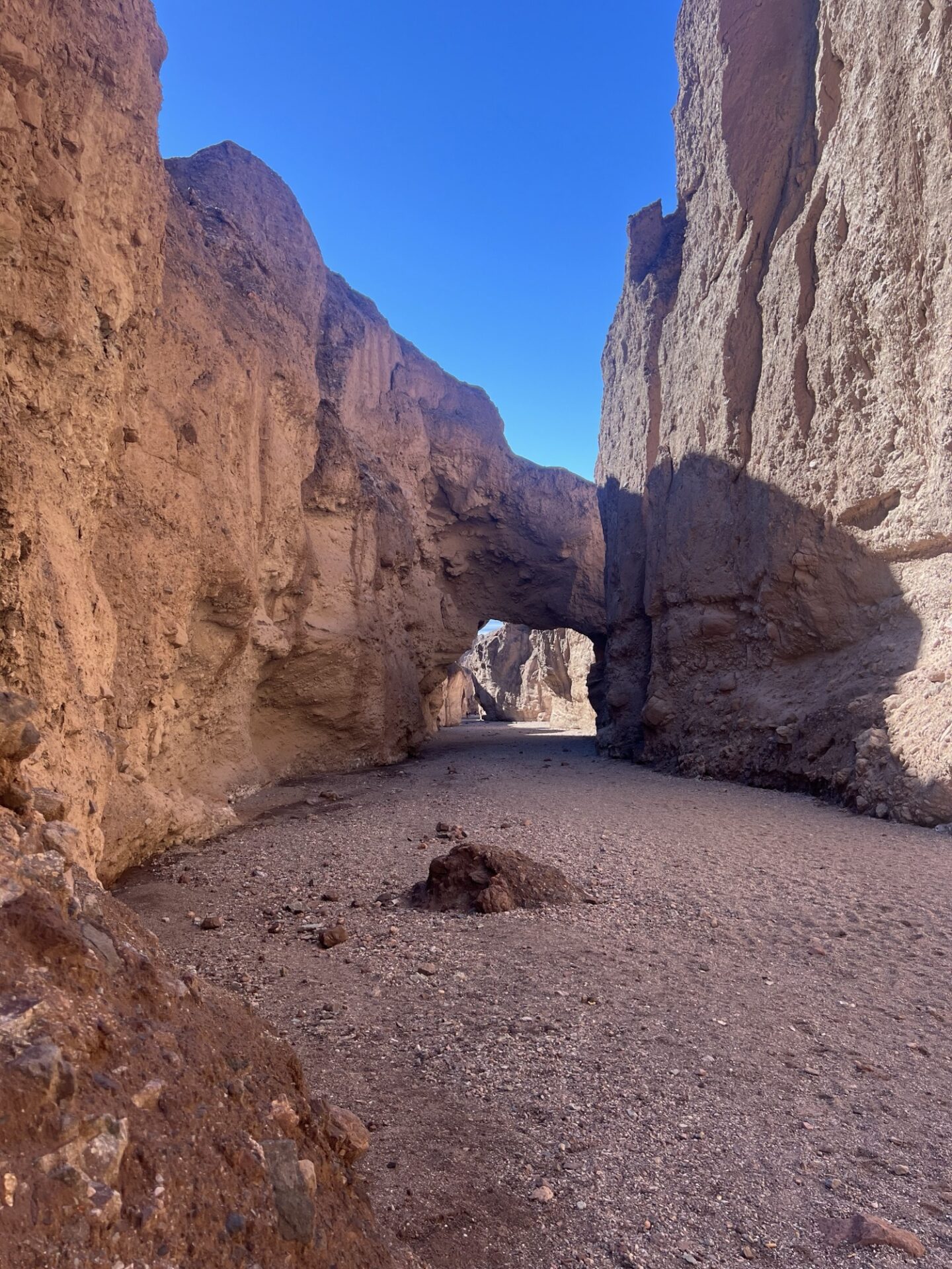
Steve arrived in camp around this time. Afterwards, we went to Zabriskie Point, and decided to try the Echo Canyon trail to see if it was driveable. It was, so we went to the Inyo Mine.
The road was in such good condition that most 2WD vehicles could have made it there. We stopped on the way back at the natural arch, and took a ton of pictures.
Very beautiful with the sunset coming through the arch. We drove home in the dark through lots of big mud puddles in the road. That night we had a big fire in camp.
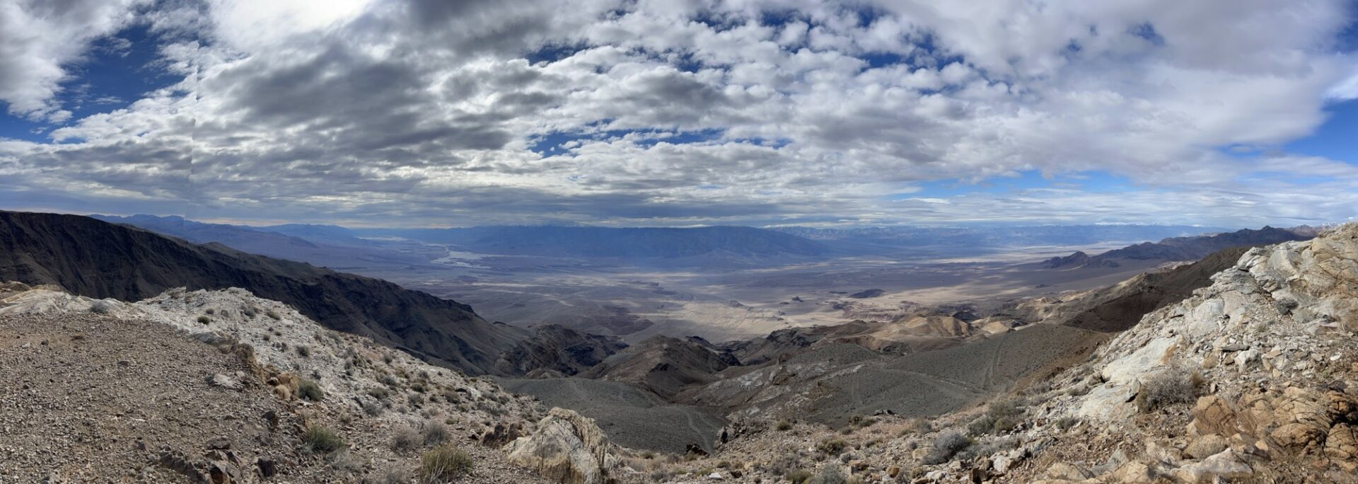
Saturday morning was dry-ish, so we decided to go to Chloride Cliffs, where we had beautiful views of Death Valley, and most of us went up a steep-ish hill at the very end that only Dick did last year.
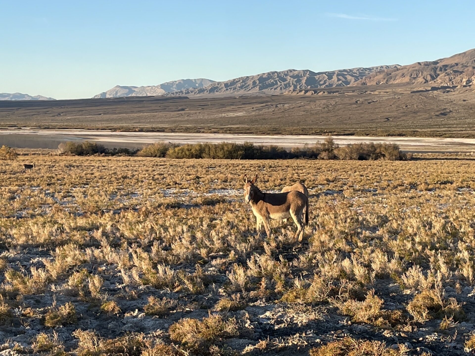
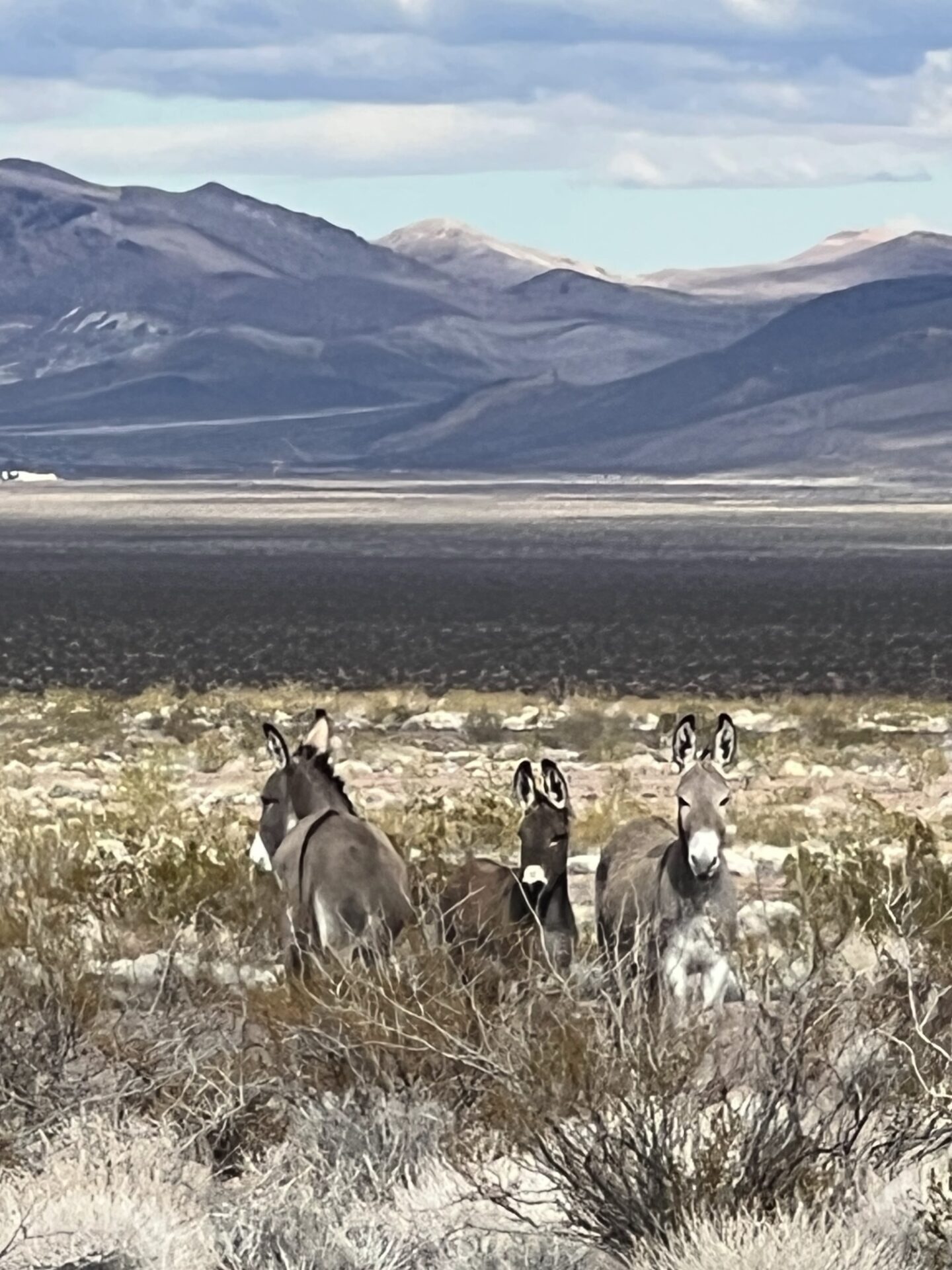
Then to Beatty via dirt roads that go down and across the Amargosa Valley (saw 3 burros).
One of the benefits of all of the rain is that there was absolutely no dust. Great for all followers. After lunch at a BBQ spot in Beatty, we took the old narrow-gauge railroad grade to the ghost town of Rhyolite, where we explored. As it was going to get dark soon, we drove home, and had another big fire.
Sunday morning, Bobbie and the Tinkers headed home, and Steve decided to do touristy things. He ended up doing a a little wheeling by himself: a portion of the Hole-in-the-Wall trail
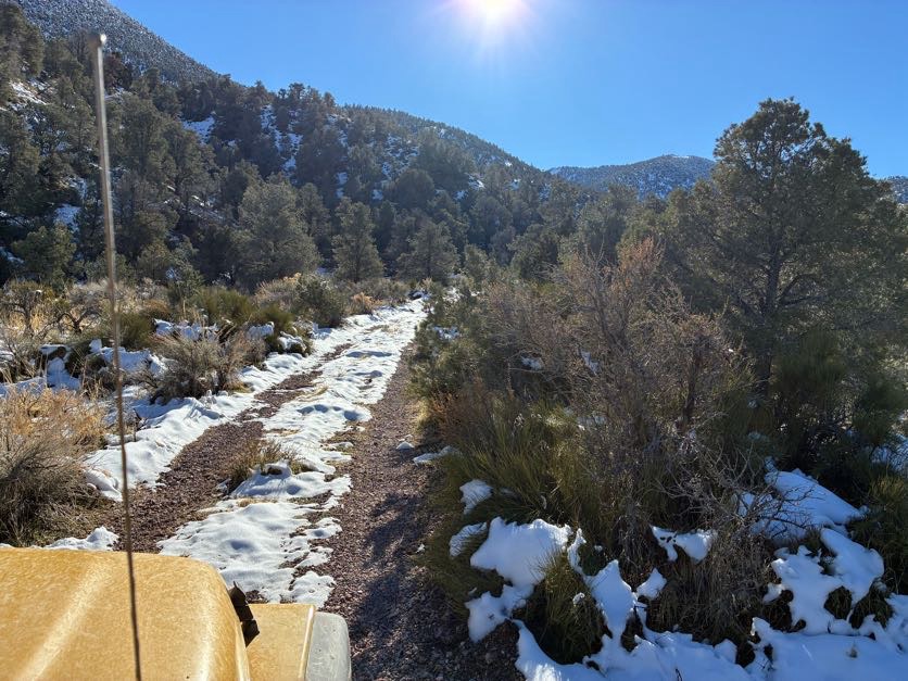
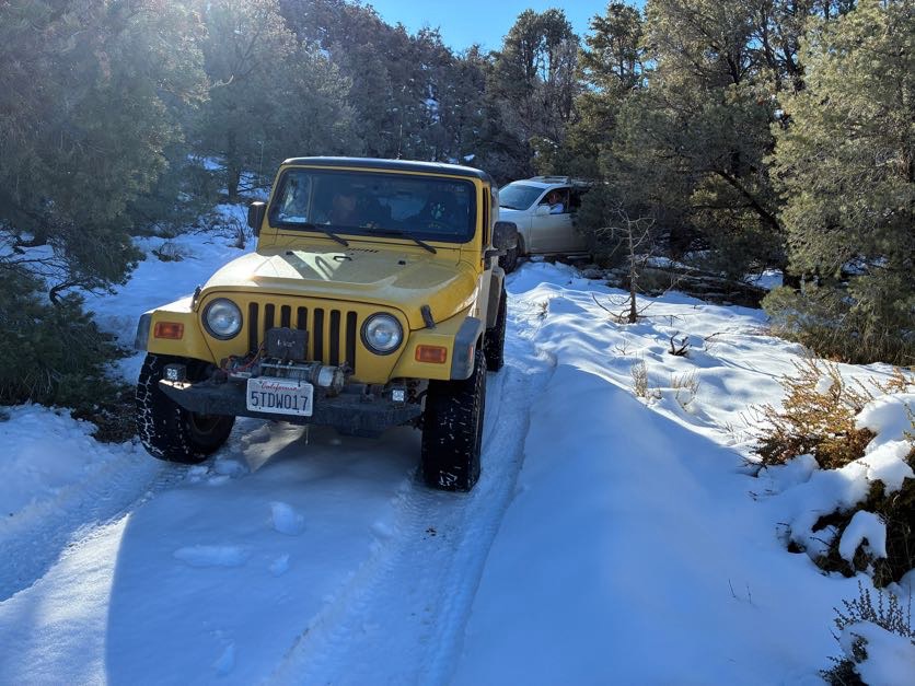
(very bumpy, he said), and Inyo Mine (I think). Brad, Myla and I returned to Rhyolite, and took dirt roads (some pretty steep) over the hills to the north, and into the Nevada Triangle portion of Death Valley. We went over a lot of alluvial plains, and eventually went up Phinney Canyon, where the landscape changed from desert-y type of brush to pine trees and SNOW on the road!
At first there were just little pockets here and there, but as we ascended, there got to be more and more, until we were driving in full snow. Woot! We were hoping to get to the end, but when the snow got to be more than 6” deep, we decided to stop, as we were at a point where we could still turn around.
There was only a little bit of slipping and sliding. Then back across the desert to Hwy 95 (saw 3 more burros), Beatty for gas, then back to STW for another big fire.
Monday morning, Steve and Brad went home, and Danny and Myla stayed in the park and did some more touristy things. We left on Tuesday morning. And thus concluded another great trip to DV.
This was originally planned to be the annual trip to Coyote Flats near Bishop, but plans were changed the day before due to some expected weather and a having a very small group of four. We decided to go to the Monache Meadows area in the southern Sierra Nevada mountains within the Inyo National Forest, which is somewhat nearer but still a fair trek up the 395 and over to Kennedy Meadows along Nine Mile Canyon Rd.
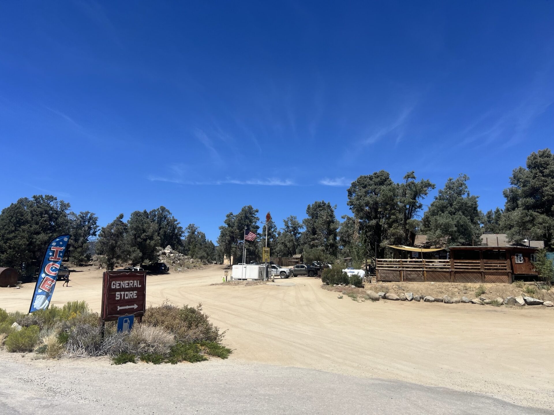
Wednesday 8/20. Three of us met and set off from Albertsons at the Casitas Pass Rd exit of the 101 in Carpinteria, Mike with Freya the Australian Cattle dog in his impressive 73 Chevy K5 Blazer, Dave in his nicely built 4Runner and me in my Rubicon 4xE. We were meeting Brad in his luxury Lexus GS off-roader at the Kennedy Meadows General Store.
Kennedy Meadows General Store
We made good time to Kennedy Meadows, met with Brad, had a burger and paid $7.49 a gallon for gas! The store is a meeting place for PCT hikers, and they can have packages delivered there for when they arrive, as well has check in on Wi-Fi and camp.
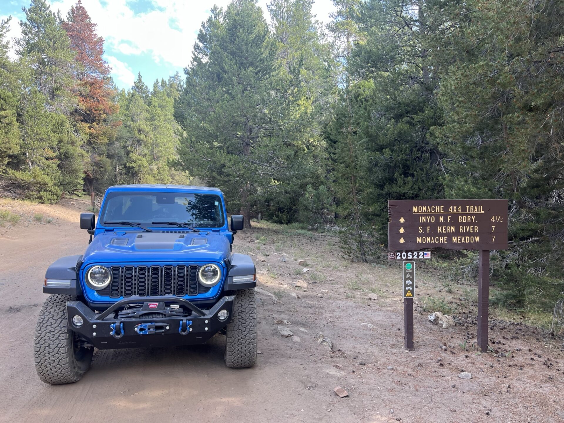
None of us were familiar with the area, but I had planned a route to a campsite that was recommended by Brent, the original leader of the Coyote Flats trip, using onX Offroad. This looked like we could get there on mostly unpaved road, but after going down several tracks and hitting dead ends or a motorcycle trail, we realized that was going to work. Dave was using Gaia and navigated us to the Monache Jeep Road 34E38 via Blackrock Road 21S03 and Smith Road 21S36. Monache Jeep Trail is a fun trail that’s marked as easy in the California Back Roads book, but it has some parts that make you think but nothing that’s going to damage your rig, unless you’re not paying attention!
Monache Trailhead
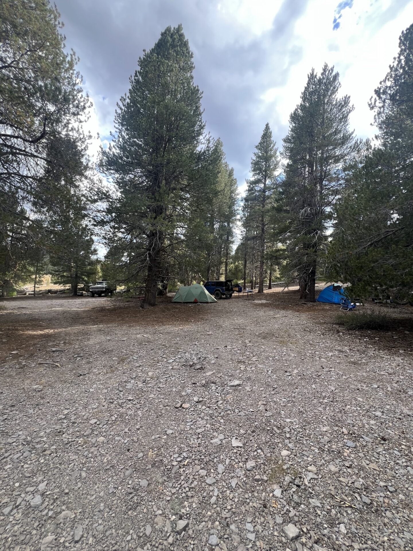
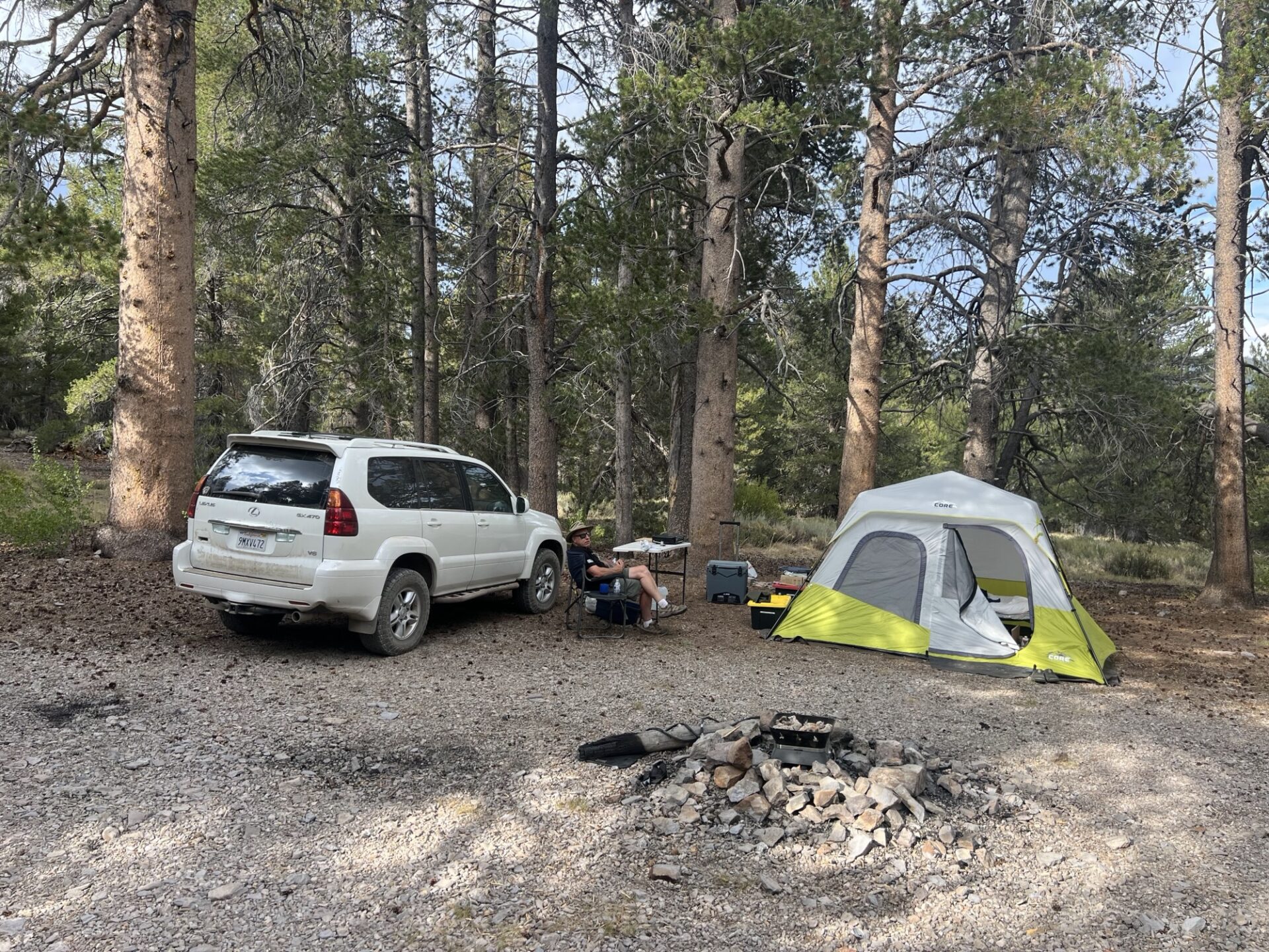
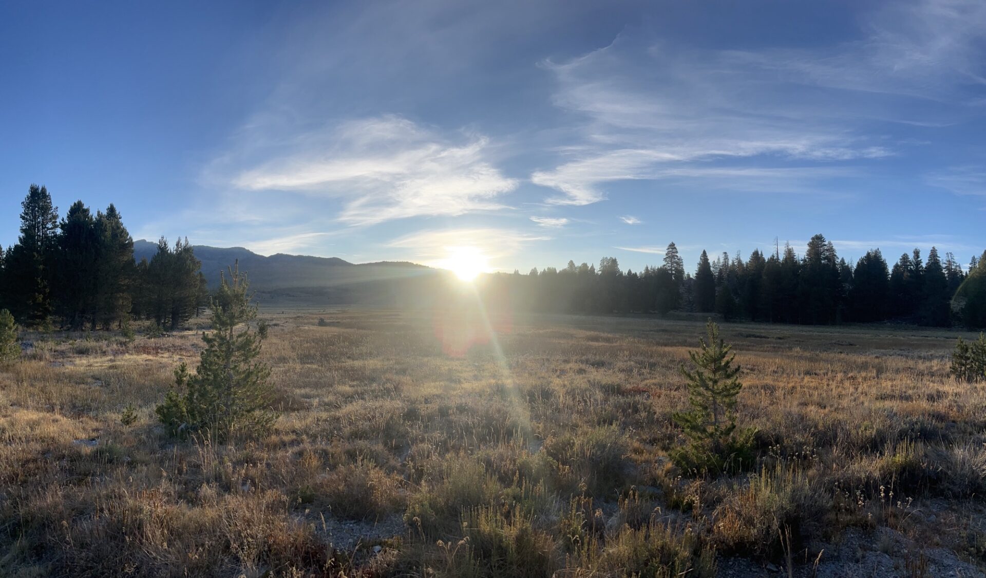
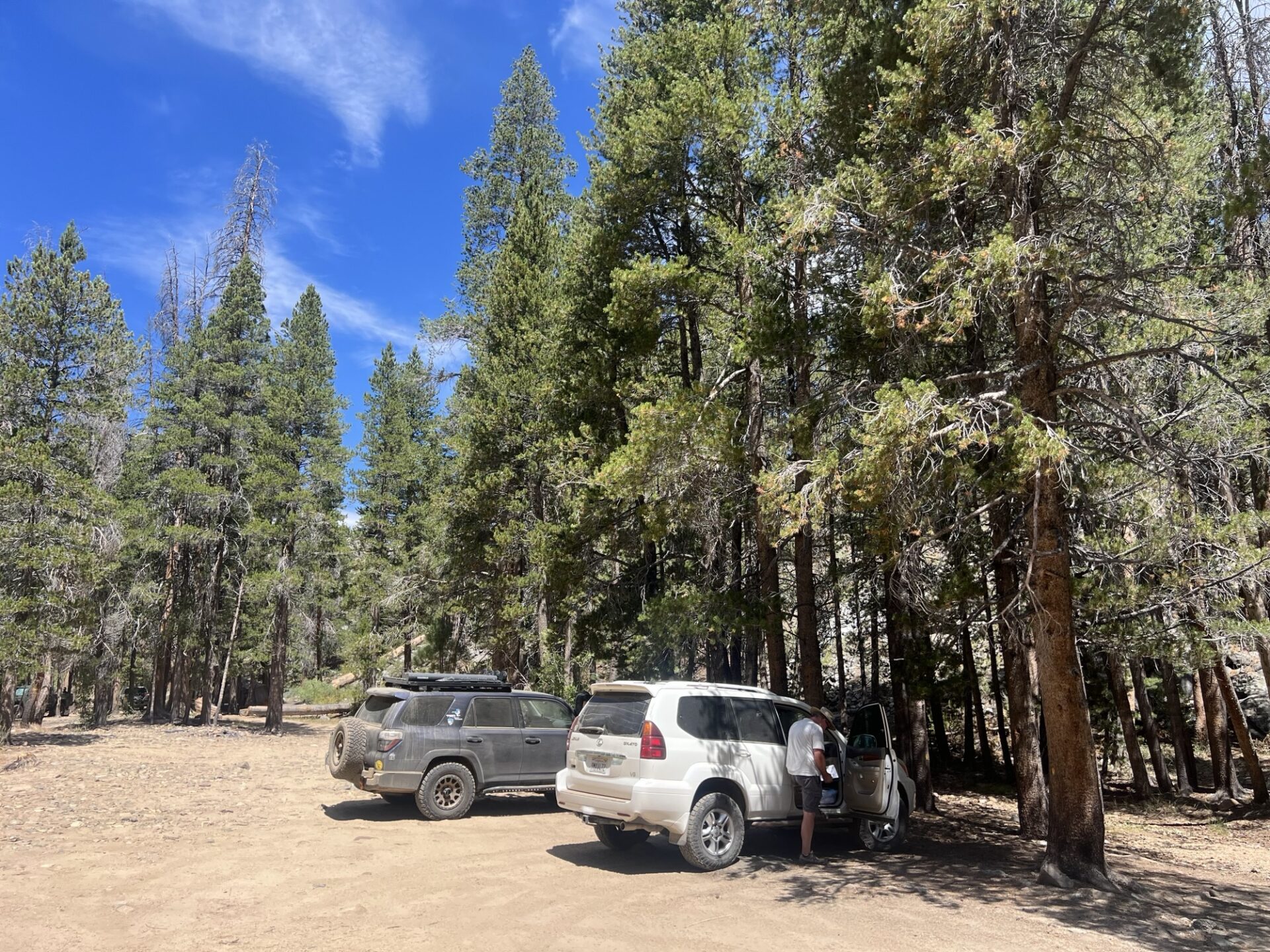
The trail leads to Monache Meadows which opens, as you would expect, to a beautiful meadow. There are many dispersed campsites along the trail and the site that Brent recommended was taken, but we managed to secure a beautiful site with plenty of room for the four us on the opposite side of the Meadow. We had shade, were able to spread out so we weren’t on top of each other, and we couldn’t see or hear any other sites. Perfect! The site was at about 8,000ft elevation.
By the time we had set up camp it was about 6pm with the temperature in the 60’s. Later in the evening we gathered round Dave’s gas fire pit to chat (no open fires allowed), and for some well-earned drinks and snacks. Overnight we all commented that it was a lot colder than expected.
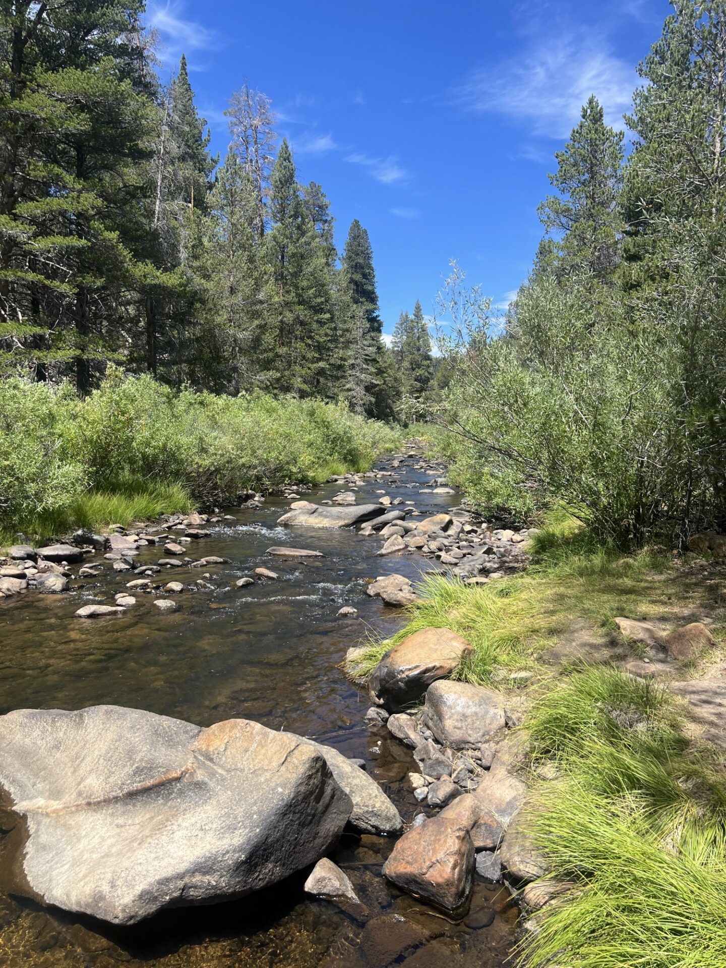
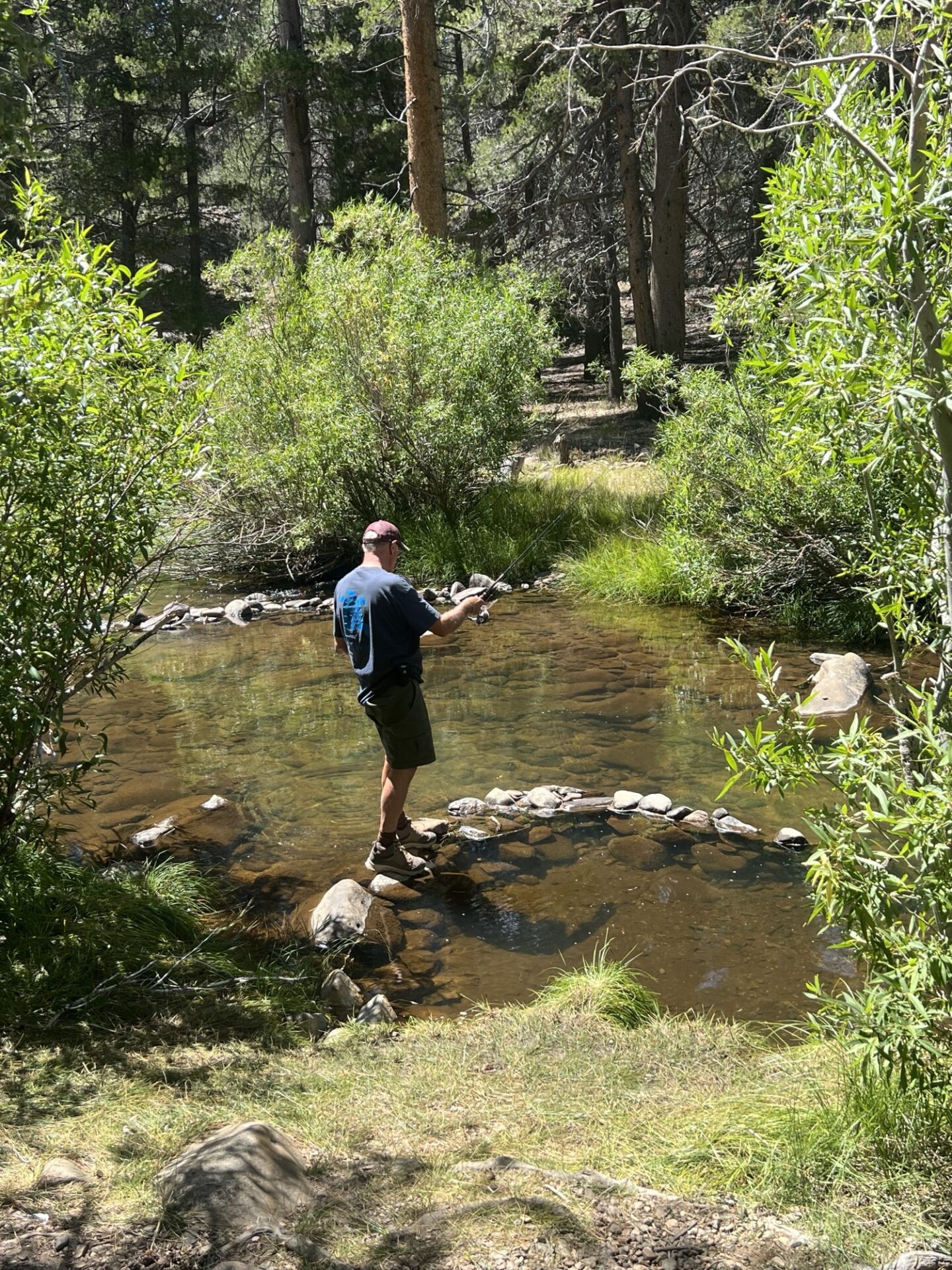
Thursday 8/21. The sound of Coyotes howling and yipping was the morning chorus as we had coffee and breakfast. Brad, Dave and I went exploring all the trails in the area up to the South Fork of the Kern River. There are a lot of campsites near the river and they’re a popular destination. There are also Golden Trout in the river and Dave went for a hike, dropped a line and caught a couple of small trout. Brad and I continued to explore the rest of the trails in the area which where all dead ends across the meadow. Very nice though. We saw a hunter with a crossbow and wondered what he might be hunting. Then we noticed Deer Island on the map, so I guess that explained it.
Mike and Freya chilled back at camp and fixed a couple things he needed to on the Blazer. The latter part of the day was chilling back at camp, throwing the ball for Freya, reading a book in the hammock and cooking dinner. Later that evening we regrouped around the gas fire pit until the gas ran out so had to use my new telescopic LED light to provide some ambient light. Something spooked Freya while were sitting but we couldn’t see anything in the dark of the trees and we didn’t get visited by bears, at least that we know of! Freya sacred them off.
Friday 8/22. Using my Starlink, I was determined to find out what had gone wrong with my navigation using onX on Wednesday. I subscribed to Gaia and downloaded offline maps to see if that was any better. The route looked very similar but undeterred, the four of us decided to head back towards Kennedy Meadows General Store via the Monache Jeep trail and paved road, top up with gas – did I mention it was $7.49 a gallon – and try and make our way back on trails following Gaia. On the way back to the store we stopped in at Blackrock Information Center. The two volunteers were very knowledgeable about the area and when we showed the route on Gaia, they said it’s not doable. Many of the trails were motorcycle only and we weren’t the first to have this issue, several others using onX and other apps had the same issue. So, I feel a little better that it wasn’t my incompetence, not all of it at least.
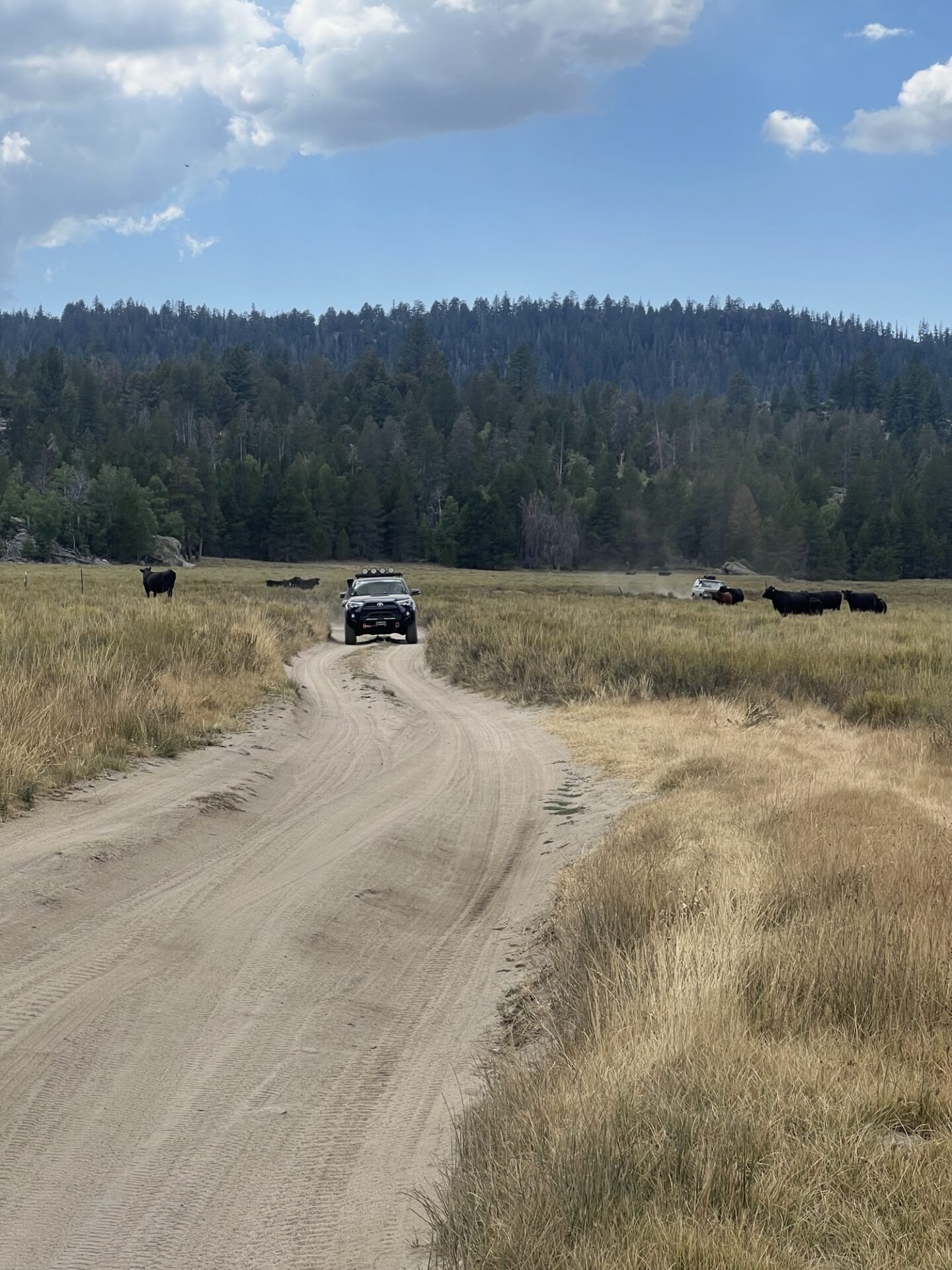
We headed back towards camp, but Brad had more exploration on his mind and took the Beach Road 21S02 to an old corral in Beach Meadows. We all enjoyed another trip down the Monache Jeep Trail and back to camp. Along the way, Dave launched the drone which followed us back along the meadow, through a heard of cows.
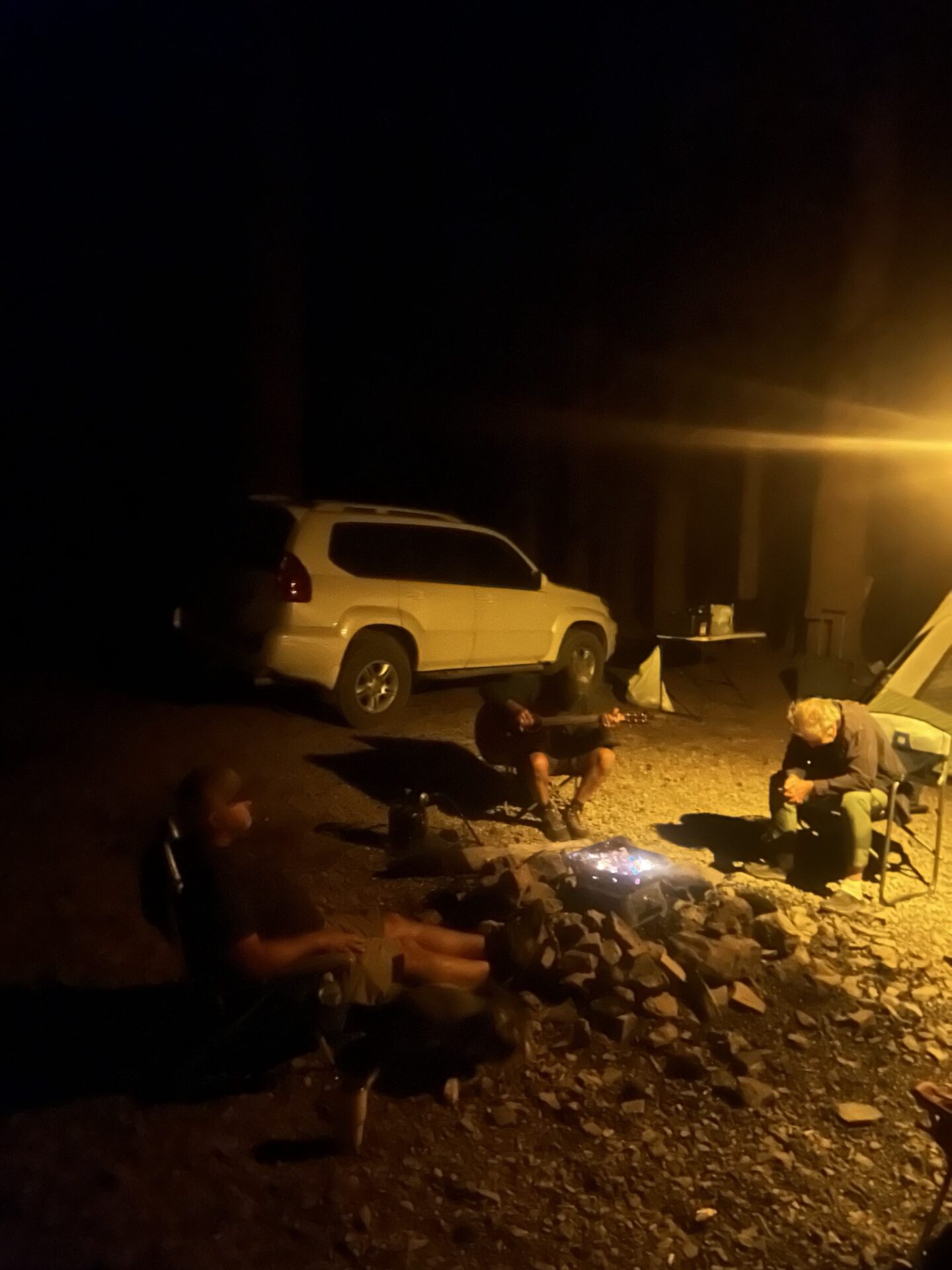
Friday night at camp, Dave and I had a Chili cook off, Brad and Mike were the testers. Both delicious and different in their own way was the verdict.
Dave had refilled his propane at Kennedy Meadows General Store and that evening we were able to sit around the gas fire pit again. Dave played us a few songs on his guitar, and we enjoyed some gummy bears, Scandinavian Swimmers, popcorn and cookies. Oh yeah, and we finished off the Old Fashioned and Woodford Reserve.
Saturday 8/23, departure day. We packed up camp and left around 8am as we had a long day ahead of us and wanted to visit the Bald Mountain Lookout Tower, and Kern River Brewery for lunch.
One more time across Monache Meadows and up Monache Jeep Trail. On the way up the trail, Mike’s battery came loose with all the bouncing around and started arcing to the Blazer’s metal frame. Smoke came from under the hood and started filling the cabin area, and fortunately there was no lasting damage and Mike was able to secure the battery and complete the rest of the trail.
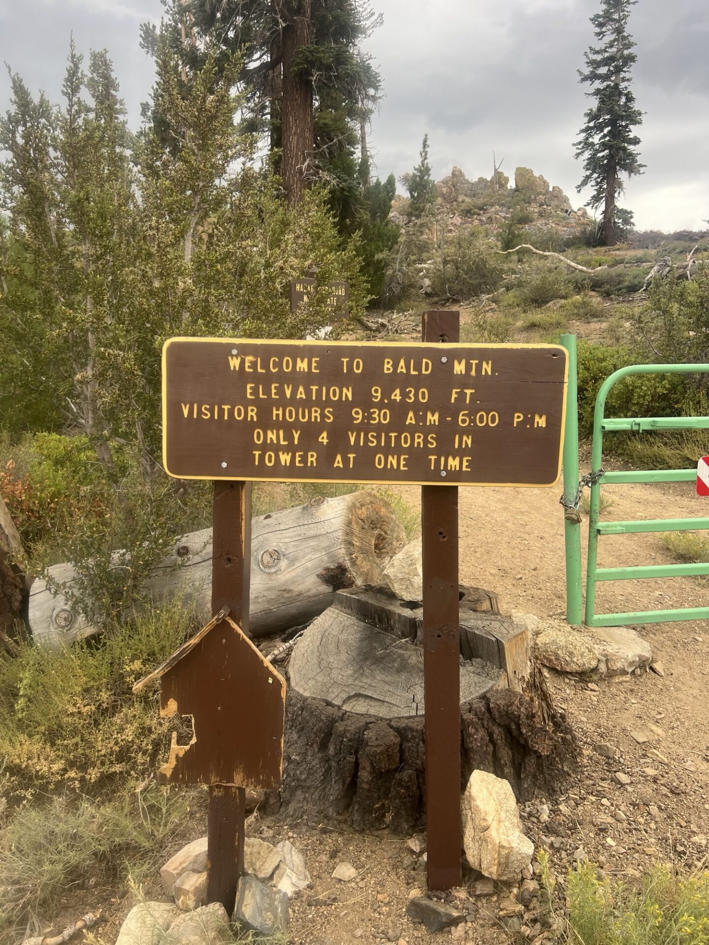
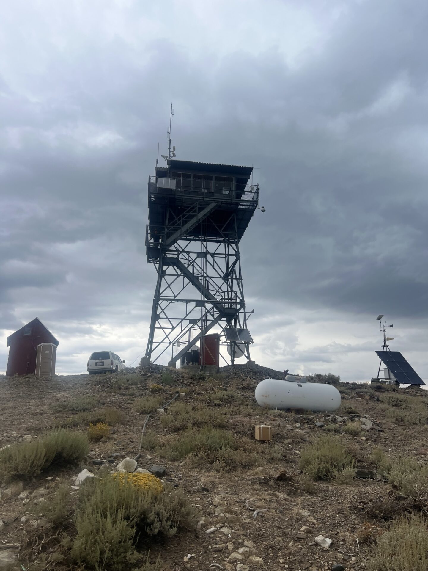
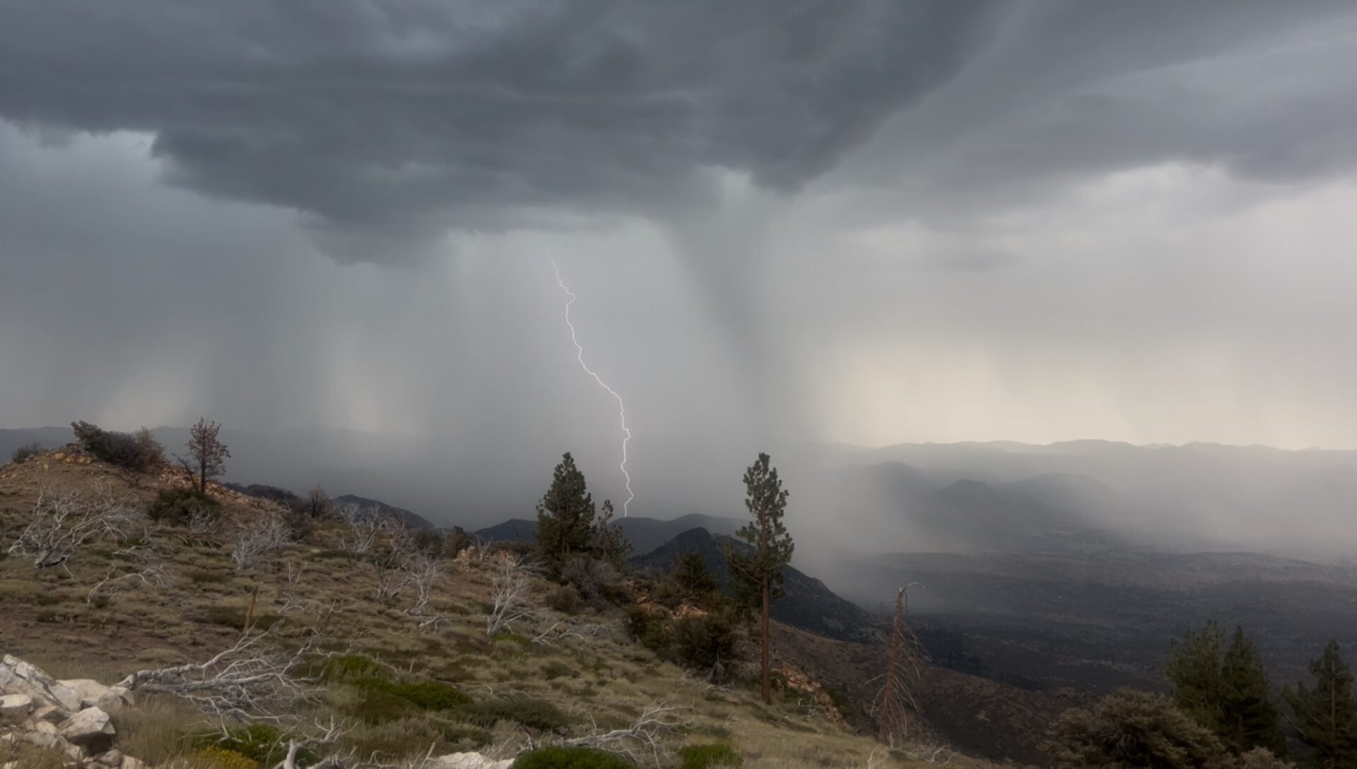
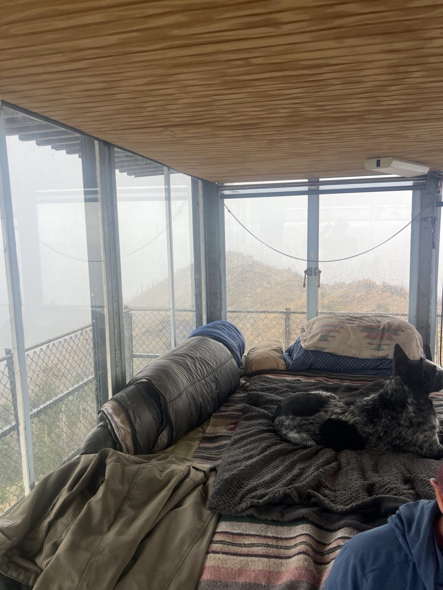
We aired up at Blackrock Information Center and made our way to Bald Mountain Lookout Tower, a manned lookout tower at 9,400ft elevation in the Domeland Wilderness on the Sequoia National Forest. By now the clouds were moving in and were pretty dark. When we got to the trail, we need to hike up about half mile or so and we could hear the rumbles of thunder and see a couple of flashes of lightning. We go to the tower just in time as the heavens opened. We could clearly see lighting strikes as we climbed the metal steps of the metal tower on top of a mountain. We were ushered in by Glenn, the ranger who lives up in the tower with his cattle dog until October. It can’t be more than 15ft square, but he has everything he needs. We watched the lightning get nearer and eventually pass. Although the tower is grounded, I wasn’t completely comfortable, particularly as Glenn was stood on a glass insulating mat that he’d been advised to stand on during a storm. We couldn’t all get on the mat.
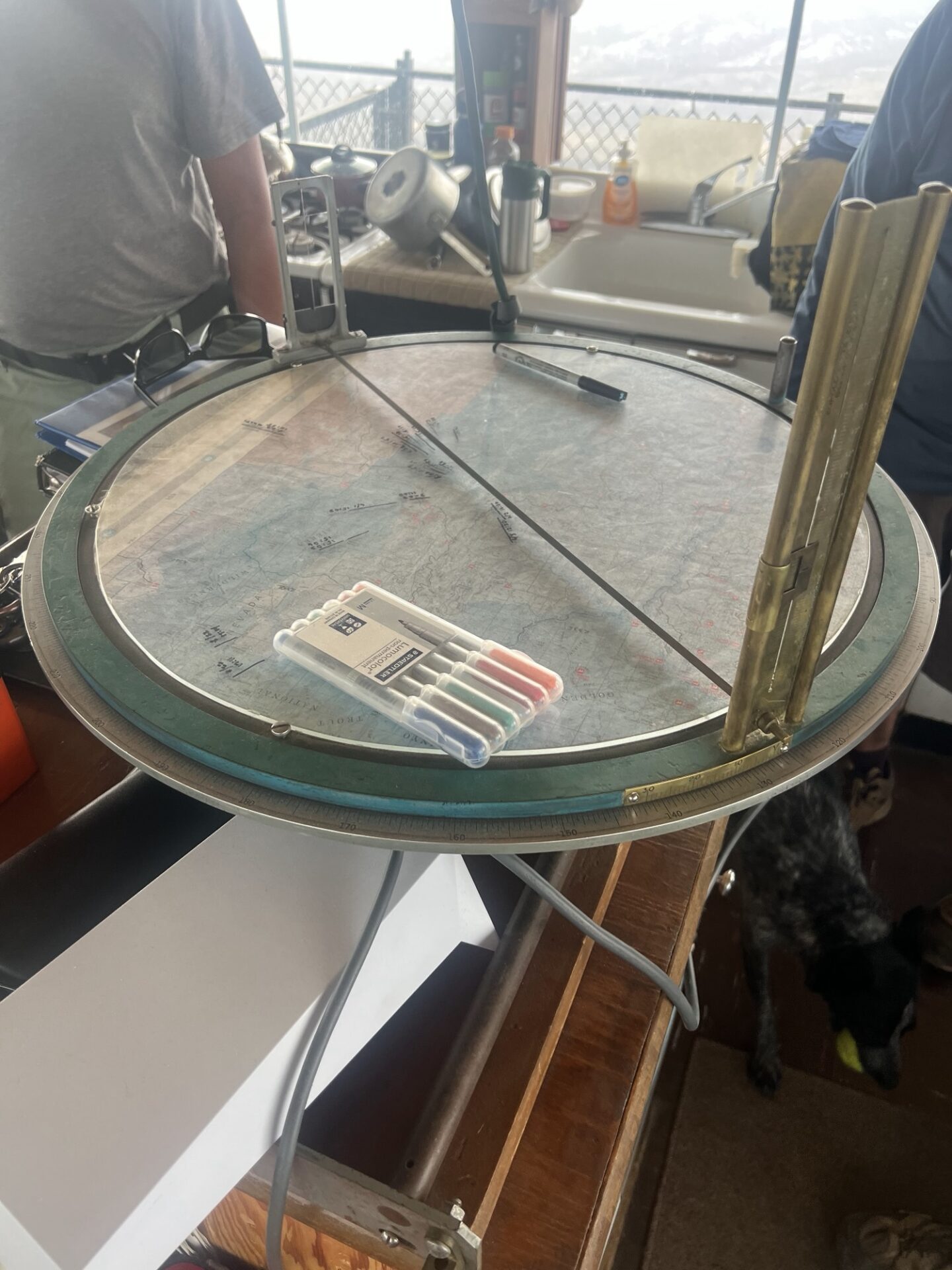
Anyway, we live to tell the tale and it was an incredible experience. The timing of our visit couldn’t have been any better. Glenn showed us the tool he uses for guiding responders to any fires in the area, an Osborne Fire Finder which is a circular map with sighting crosshairs enabling him to pinpoint the exact geographic location of a smoke column. We also learned that an ember from a lightning strike could be dormant in a tree for several weeks, or even months, before erupting into a wildfire.
Once the storm had more or less passed, we made a hasty retreat down the metal steps and to the relative safety of our vehicles. Next stop Kernville.
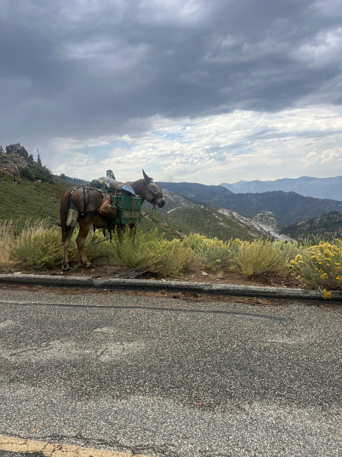
The Sherman Pass Road to Kernville was a beautiful scenic windy road down the mountain to the North Fork of the Kern River. There was one last surprise, a man with a mule walking the road. Dave asked where he was going and he said “Nowhere”. I took a picture of the mule and later noticed a url printed on his cargo, 3mules.com. The man, Mule or Monk, is 77 years old and has been living outdoors full time since 2001 moving between San Diego and Sacramento. There’s even a Mule Tracker on the website!
We arrived at Kern River Brewery, and this is where the group split and went our separate ways. Brad and Dave had lunch at the brewery, Mike and Freya headed back to Santa Barbara via Bakersfield and I headed back via Mojave and Antelope Valley. Dave stayed out for an extra night in Carizzo Plains on his way home.
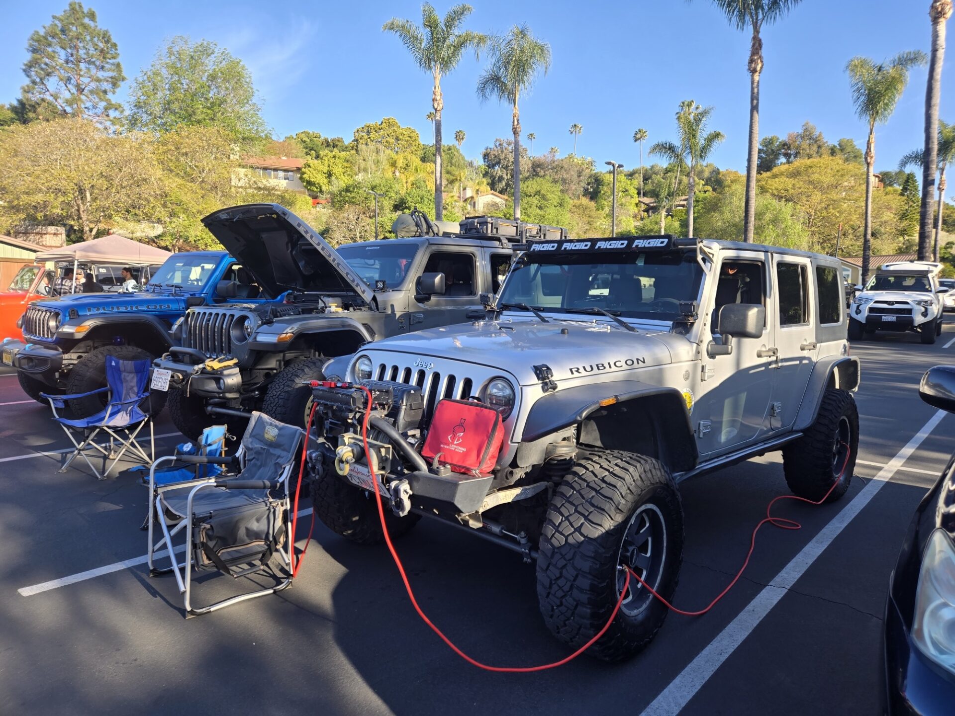
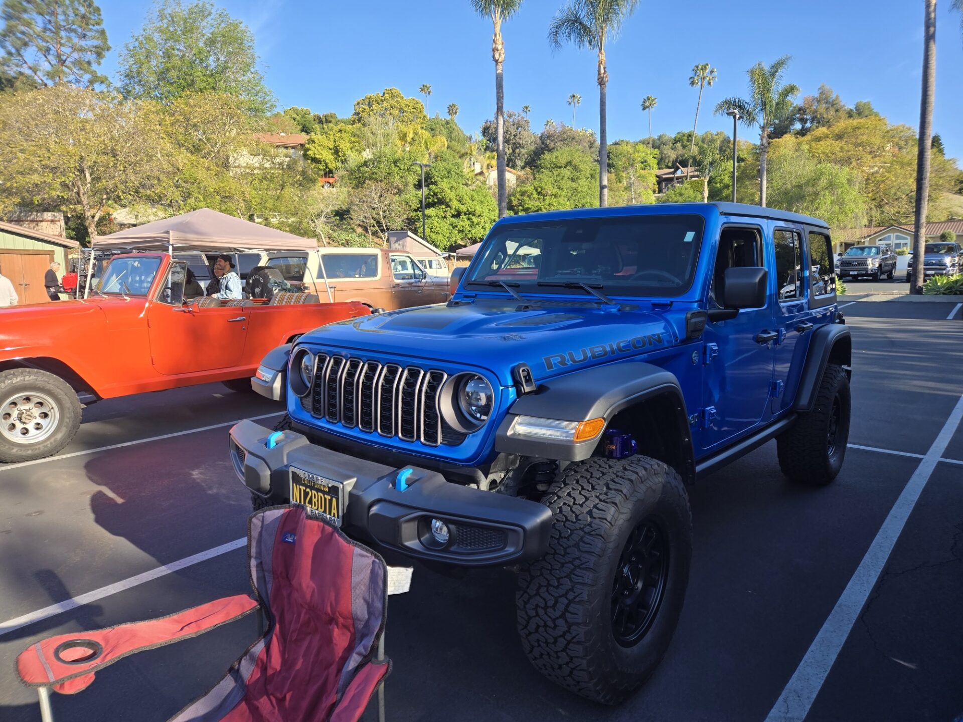
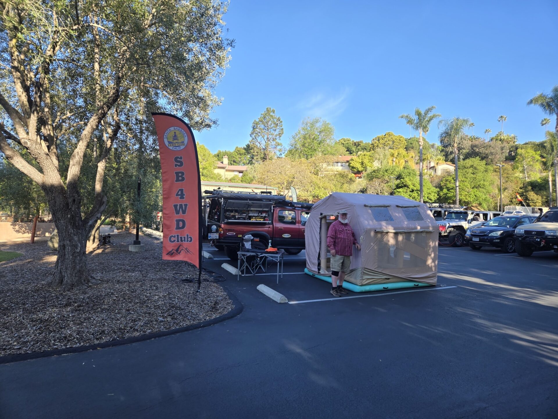
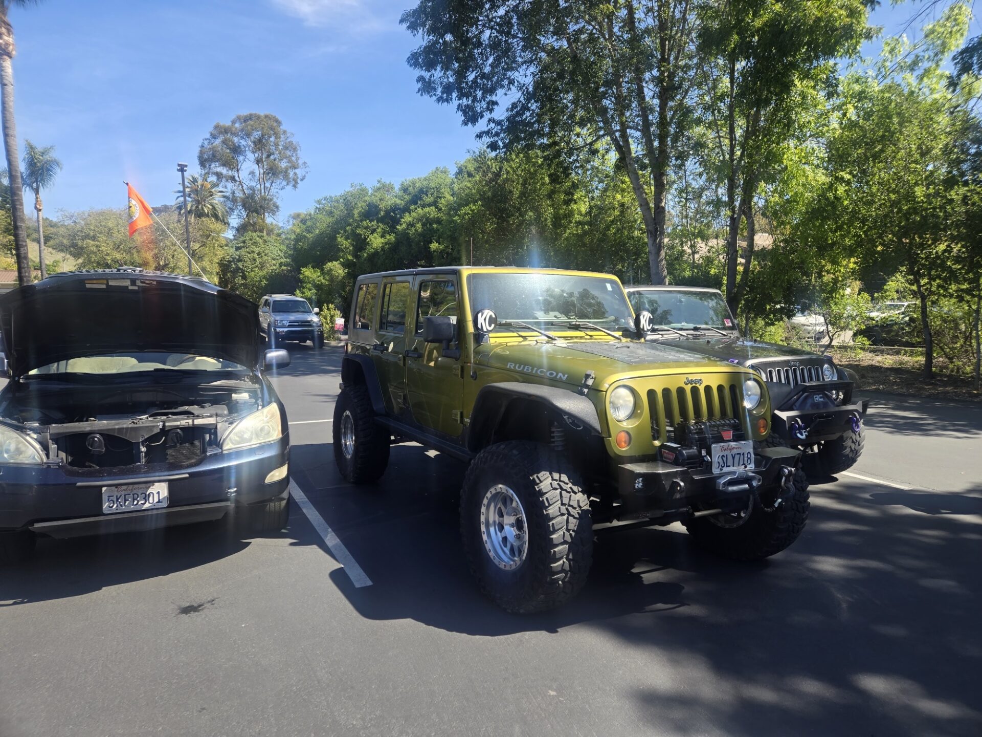
On Saturday April 5th the Santa Barbara 4WD Club rallied our troops to again support Vallor on the Greens and their local Pour-Overland fundraising/charity show and coffee social event at the South Coast Community Church.
Many of our members came out to support this event for disabled 1st responders and Military Veterans by displaying their rigs and gear and helping to raise money for this worthy cause.
There was also event related merchandise, breakfast burritos, bakery items, coffee and homemade cookies for sale as well. The raffle had many popular items to be passed out and was very popular too.
Thanks again to those members who came out to support this fundraiser by displaying their rigs and for those other members who also showed up for support of the event and our club.
Members, for more photos from the event, please checkout (and contribute items) the club album photo album in the members only section of the website